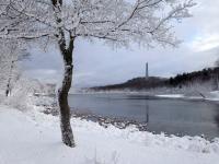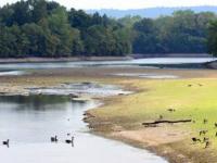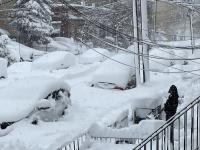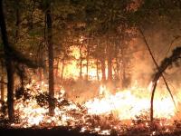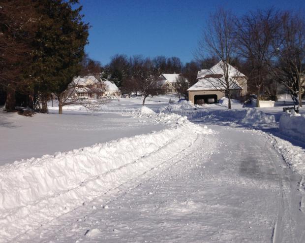
Snow in Hillsborough (Somerset County) on January 24, 2016, a day after a blizzard dropped 1.0–2.5 feet of snow over most of the state.
December Overview
The atmosphere was in a progressive mode throughout December, which explains why no particular weather feature lingered in NJ or elsewhere across North America for too long. The seemingly day-to-day changes resulted in the statewide mean temperature of 36.4° being just 1.2° above the 1981–2010 normal. This ranks as the 28th mildest December since statewide records commenced in 1895, a far cry from last year’s record mild conditions. Despite there being seven precipitation events, one of which was mainly a carry over from November 30th, the rapid movement of these systems meant that none deposited prodigious totals in NJ. Thus 3.37” fell, which is 0.48” below average. This ranks as the 55th driest December. Monthly statewide snowfall averaged 2.0”. This is 2.1” below the 1981–2010 average and ranks 45th least snowy. The northern seven counties averaged 5.5”, the central six counties averaged 1.8”, and the eight southern counties 0.2”, all below average.
Temperature
There were 14 December days with minimum temperatures at one or more NJWxNet station in the teens or colder. Of these, eight saw a station get to 14° or lower. The first of these was on the 10th, with Walpack (Sussex County) dropping to 10° and Pequest (Warren) to 14°. The following day, Walpack reached 8° and Pequest again 14°. High Point Monument (Sussex) saw a low of 9° and a high of 21° on the 15th, when three south coastal stations maxed at 44°. The 16th found High Point (Sussex) down to 3° and the nearby Monument station and Walpack 5°. West Cape May (Cape May) had the “mildest” minimum at 20°. This was the first day of the season where all NJWxNet stations remained below freezing all day, the Monument only reaching 19° and West Cape May 32°. High Point Monument dropped to 14° on the 17th and Walpack 6° on the 19th. The 20th was the coldest December morning, with Walpack at 0°, Pequest 2°, Hope (Warren) 4°, and 11 stations between 5°–9°. Walpack was 11° on the 21st.
The daily maximum temperature was 50° or higher somewhere in NJ on 13 December days, including six with a maximum of exactly 53°. The 1st nudged out the 18th as the warmest day, with Woodbine (Cape May) reaching 67°, 13 stations at 65°, and 25 sites between 60°–64°. High Point Monument was coolest at 45°. A 53° maximum was achieved at six stations on the 2nd, Woodbine on the 3rd, and Sea Girt (Monmouth) on the 5th. Sea Girt was 50° on the 6th, Atlantic City Marina (Atlantic) and Woodbine 53° on the 12th, and Woodbine 50° on the 17th. Cape May Courthouse (Cape May) soared to 66° on the 18th, with five stations up to 65° and 33 sites between 60°–64°. Hope only made it to 43°. Woodbine saw 55° on the 22nd and five stations 52° on the 24th. Christmas Day found Jersey City (Hudson) up to 53°, with 31 stations 50°–52°. Six made it to 53° on the 26th, with warm conditions again invading the state on the 27th, when Mansfield (Burlington) reached 65° and 49 sites between 60°–64°. High Point Monument was coolest at 49°.
Precipitation and Storms
December precipitation totals for most NWS Cooperative and NJ CoCoRaHS stations included rain that fell after standard morning observation times on November 30th. This event was discussed in last month’s report, however, the December totals include the general 1.00”–1.50” in the north and 0.30”–1.00” in the south station measurements that were reported on the 1st. Peapack-Gladstone (Somerset) took top honors for the month with 4.72”, followed by Chatham (Morris) 4.71”, Flemington (Hunterdon) 4.68”, and Hopewell and Hopewell Township in Mercer County with 4.55” and 4.57”, respectively. On the low end, Winslow Township (Camden) received just 2.69” for the month, followed by Sea Isle City (Cape May) with 2.83”, Tabernacle (Burlington) 2.85”, and in Gloucester County, Monroe Township 2.91” and Pitman 2.97”. Aside from the inch plus totals on the 1st, only two other December events dropped as much as an inch somewhere in the state.
December snowfall added up to 16.7” at the High Point Ranger Station (Sussex) and 15.6” and 10.1” at two Wantage (Sussex) locations, 14.0” at Montague (Sussex), 7.5” in Randolph Township (Morris), 7.0” at Hardyston (Sussex), and 6.5” in Jefferson Township (Morris). There were five events where 2.0” or more fell in one or more locations. Snowfall thus far this season at High Point (25.2”) and Wantage (20.1”) exceeds totals for last year’s entire snow season (24.5” and 19.5”, respectively). It is worth noting that the combination of the far northwest corner of the state missing the majority of the January 23rd blizzard and the absence of many minor to moderate events such as have been seen already this season contributed to this most often snowiest area of the state being the least snowy last season.
A mixed rain and snow event on the morning of the 5th brought 0.10”–0.30” to most of NJ. A bit more fell in Cape May County, where Lower Township received 0.37”, North Wildwood 0.36”, and three other communities 0.33”. Up north, some stations in seven counties received measureable snow, the most being 2.1” and 1.8” at two Blairstown (Warren) sites and 2.0” in Liberty Township (Warren). A more significant storm followed from the late afternoon of the 6th to the predawn hours of the 7th. Again, Cape May County won in the precipitation department with 1.43” at Wildwood Crest, Sea Isle City and Middle Township each with 1.20”, and 1.08” in North Wildwood. Central and southern areas mainly received 0.50”–0.75”, while totals near 0.50” were common in the north. Snow fell, mainly at higher elevations, in five northern counties. Top totals included 3.8” at High Point, an elevation-induced range of 0.6” to 3.3” in Wantage, and 2.3” at Highland Lakes (Sussex).
Rain and some snow fell from late on the 11th throughout much of the morning of the 12th. Hopewell Township saw 0.77” of liquid, Robbinsville (Mercer) 0.74”, and Lebanon and Lambertville, both in Hunterdon County, received 0.72”. It was this west central region that caught the most, with 0.25”–0.50” more common elsewhere in northern and central sections and 0.25” in much of the south. Snowfall was more widespread than the two earlier events, with 11 counties having locations with measureable snow. Top totals included 3.2” and 2.2” at three Wantage sites, 3.1” in Montague, and 2.3” in Highland Lakes.
The largest storm of December arrived in the predawn of the 17th, lasting through the midday hours. As much as 1.22” of rain fell in Woodbine, 1.05” at both Upper Deerfield (Cumberland) and Stafford Township (Ocean), and 1.04” in Linwood (Atlantic) and Upper Township (Cape May). Overall, 0.50”–1.00” fell statewide. This includes rain and melted snow, as only Salem and Cumberland counties failed to have at least one station with measureable snow. Some of the more notable snowfall totals included West Milford (Passaic) with 4.1”, Vernon Township (Sussex) 4.0”, Jefferson Township 4.0”, Ramsey (Bergen) 3.8”, Tewksbury (Hunterdon) 3.5”, and Cedar Grove and Newark in Essex County 3.0”.
A predawn to early afternoon event on Christmas Eve was accompanied by mild temperatures, making snowfall out of the question. Instead, Jackson (Ocean) caught 0.75” of rain, Berlin (Camden) 0.68”, and Peapack-Gladstone 0.63”. Commonly, 0.30”–0.50” fell in southern and central regions, with closer to 0.25” in the north. Thus come the morning of the 25th, only NJ lands above 1000 feet had an inch or more of snow cover over at least 50% of the ground, thereby qualifying as a white Christmas.
Another modest predawn to afternoon event on the 29th completed the precipitation story for 2016. Rain, some of it freezing for a time in some northern and central spots, fell across most of NJ, while wet snow accumulated at higher locales. Morris Township (Morris) caught 0.48” of rain and melted snow, with Blairstown picking up 0.46”, and Belmar (Monmouth) and River Vale (Bergen) each with 0.43”. Statewide, most locations saw 0.20”–0.40”. Measureable snow fell in four counties, topped by 4.4” in Montague, 3.0” at High Point, 2.9” and 2.5” in Wantage, and 2.7” at Blairstown. An early evening thunderstorm, accompanied by pea-size hail in Estell Manor, zipped across a swath of south Jersey on the 29th and some generally light snow squalls deposited a few tenths of snow across portions of north Jersey during the 30th into the early hours of the 31st to complete this active episode.
There were several occasions when the barometer read quite high in December. Pressures close to 30.75” occurred on the 19th and just a few hundredths of an inch lower on the 26th. Lowest pressures were observed on the 1st at 29.45”–29.50”. The 18th exhibited a huge swing in pressure, with barometers rising from about 29.70”–29.75” around dawn to 30.45”–30.50” by midnight.
Given the sharp pressure gradient, there is no surprise that it was windy on the 18th. This was one of nine days where one or more NJWxNet locations had gusts equaling or exceeding 40 mph. Fortescue (Cumberland) gusted to 53 mph on the 1st. High Point Monument reached 44 mph on the 3rd and 55 mph on the 9th. The Monument station peaked at 52 mph and Fortescue 50 mph on the 15th, along with 15 stations between 40–49 mph and 31 sites from 30–39 mph. Sea Girt had a monthly peak of 59 mph and High Point Monument 58 mph on the 18th. The Monument station got to 43 mph on the 22nd, 44 mph on the 24th, and 48 mph on the 25th. Along with Berkeley Township (Ocean) and Pennsauken (Camden), the Monument gusted to 40 mph on the 27th.
Annual overview, including the ONJSC’s Top 10 NJ Weather and Climate Events of 2016
The majority of this annual review focuses on the eighth annual top 10 list. Before getting to that, a brief recap of annual temperature and precipitation is in order. The statewide annual temperature of 55.0° was 2.1° above average (3.3° above the 1895–2016 average). This ranks as the 3rd warmest year on record (2015 was 11th warmest; top 10 warmest listed in Table 1). Notice that all of the top 10 years have been since 1990. 14 of the top 20 warmest years over a 122-year period of record have occurred since 1998. More interesting 2016 thermal rankings are found under #2 on the top 10 list below.
| Rank | Year | Annual Avg. Temp. |
|---|---|---|
| 1 | 1931 | 58.5° |
| 1 | 2012 | 55.9° |
| 2 | 1998 | 55.2° |
| 3 | 2016 | 55.0° |
| 4 | 2006 | 55.0° |
| 5 | 2011 | 54.9° |
| 6 | 2010 | 54.7° |
| 7 | 1990 | 54.5° |
| 8 | 1991 | 54.4° |
| 9 | 2002 | 54.3° |
| 10 | 1999 | 54.1° |
Table 1. The 10 warmest years across New Jersey since 1895.
Annual precipitation (rain and melted frozen precipitation) averaged 40.18”. This was 6.18” below average, ranking 27th driest. While all but the extreme southern portion of the state was below average, it was much more notable in the north. The National Centers for Environmental Information’s northern NJ climate division (all counties north of and including Hunterdon, Somerset, and Union) averaged 38.30”, which is 10.33” below average and ranks as the 10th driest (Table 2).
| Rank | Year | Northern NJ Annual Avg. Precip. |
|---|---|---|
| 1 | 1965 | 30.84” |
| 2 | 1963 | 34.69” |
| 3 | 1964 | 34.69” |
| 4 | 1930 | 36.22” |
| 5 | 2001 | 37.10” |
| 6 | 1917 | 37.91” |
| 7 | 1941 | 38.11” |
| 8 | 1980 | 38.24” |
| 9 | 1895 | 38.28” |
| 10 | 2016 | 38.30” |
Table 2. The 10 driest years in the northern division of New Jersey since 1895.
The southern division (includes all but extreme coastal Atlantic south of and including Mercer, Middlesex, and Monmouth counties) averaged 41.13” for the year, which is 3.92” below average and ranks 42nd driest of the past 122 years.
Examining specific communities, 2016 brought 48.86” to Egg Harbor Township (Atlantic), tops in NJ. A small wet outlier area in the northeast saw 47.74” at Little Falls (Passaic), and then back in the south 47.50” fell in Cape May (Cape May), 46.66” at Woodbine, and 45.83” in Ocean City (Cape May).
Lowest annual totals were found in central and northwestern communities. The Sussex (Sussex) NWS Cooperative station only caught 34.63”, and two Woodbridge (Middlesex) sites recorded 35.85” and 36.49”. Hackettstown (Warren) only saw 35.88”, Greenwich (Warren) 36.15”, South River (Middlesex) 37.45”, and Moorestown (Burlington) 38.22”. The Sussex total was 13.22” below normal and ranks 5th driest over the past century.
ONJSC’s Top 10 NJ Weather and Climate Events of 2016
Listed below is the Office of the NJ State Climatologist's ranking of the top 10 weather and climate events of 2016. More about each event can be found in the monthly narratives posted on njclimate.org. You might be tempted to rearrange the rankings, particularly as some of the events down the list may have affected you more than others ranked higher. Or perhaps you best recall one that didn't make the list. That's the enjoyment (and frustration!) of lists. Unless stated otherwise, observations are based on an average of several dozen stations. The period of record for monthly and annual departures is 1981–2010; while for extremes and rankings it is from 1895–present.
- January 23rd blizzard.
- Record and near record snowfall of 1.0–2.5 feet over most of the state. Top honors went to 30.0" totals at Long Valley (Morris County), Succasunna (Morris), and Bernards Township (Somerset).
- Wind gusts to 64 mph at Harvey Cedars (Ocean) and 60 mph at Sea Girt (Monmouth). Six other of the 65 NJWxNet stations gusted between 50–57 mph, 14 from 40–49 mph, and 19 from 30–39 mph.
- Moderate to severe coastal flooding, especially along the southern coast.
- Top 10 warmth
- Annual: 3rd warmest on record, with a mean of 55.0°. Tied with 2006 and behind #1 2012 and #2 1998.
- Seasonal: winter 2nd mildest, spring 10th, summer 2nd, and fall 6th.
- Monthly: March 4th, July 7th, August 1st, and September 4th.
- Drought
- Statewide annual precipitation of 40.18” was 6.18” below normal.
- 9 of 12 months with below normal precipitation, with March 9th driest.
- The northern climate division had its 10th driest year since 1895, while the southern division ranked 42nd driest.
- NJ Department of Environmental Protection issued a Drought Warning for the 14 northern counties on October 28th.
- National Drought Monitor had NJ in varying levels of drought from summer onward. End of year situation included Severe Drought in most of the north, tapering to Moderate and Abnormally Dry southward.
- Windy days
- Five days with winds gusting above 60 mph at one or more NJWxNet or National Weather Service airport stations. Maximum gusts included January 23 (64 mph Harvey Cedars), February 24 (62 mph Berkeley Township), April 26 (61 mph Cream Ridge), June 8 (72 mph Upper Deerfield), July 18 (68 mph Linden, Union), and November 21 (60 mph High Point Monument).
- 57 days with winds gusting to 40 mph or higher. Of these, 37 had gusts of at least 50 mph.
- Statewide, several especially windy days, including January 23rd, March 28th, April 3rd, May 8th, June 8th, and December 15th.
- Record-breaking early- and late-season warmth contributes to lengthy growing season
- March 9th–10th temperatures into low 80°s both days in portions of southern and central NJ. The back-to-back 82° and 83° days at the New Brunswick (Middlesex) NWS Cooperative observing station were the earliest days on record (back to 1893) above 76°.
- October 19th one of the warmest late-season days on record across NJ. The 88° maximum at New Brunswick (Middlesex) was the latest in the year that mark or higher had been reached at this location in the past 124 years.
- Ten-day to two-week early green up in March, with a similar delay in leaf fall from October into November.
- Severe summer storms
- Early on Memorial Day (May 30th), the NJ Turnpike corridor northward to Middlesex County received over 4.00" of rain in several locations.
- June 21st microburst damaged homes and airport facilities in Rio Grande (Cape May). Storms throughout southern NJ brought a gust to 58 mph in Fortescue and power outages to 10,000 customers.
- July 14th: White Township (Warren). EF0 tornado was the first confirmed in NJ since October 7, 2013. Estimated winds were 75 mph, with the tornado estimated to be 75 yards wide and traveling a 2.8-mile route. Tree and building damage occurred but there were no injuries reported.
- July 25th: Readington (Hunterdon) to Branchburg (Somerset). EF1 tornado with peak winds of approximately 90 mph. It touched down in Readington (Hunterdon) and remained on the ground for 3.49 miles to Branchburg (Somerset). The maximum width was 75 yards as the storm damaged buildings, trees and cars, but injured no one.
- July 29th. Princeton-Plainsboro (Mercer) received as much as 7.23" of rain.
- July 30th. Western Somerset and portions of Hunterdon counties caught as much as 6.00" (radar estimate) and a location in Berkeley Township saw 6.48".
- February 24th nor’easter
- Heavy rain (some in thunderstorms) brought on scattered flash flooding. As much as 3.07” fell in Salem (Salem) and 2.91” at Verona (Essex).
- Wind gusts to 62 mph in Berkeley Township, 50–55 mph at seven stations, 40–48 mph at 13 locations, and 30–39 mph at 33 stations (of the 65 in the NJ Weather and Climate Network: NJWxNet). Strongest statewide winds since Sandy (though generally 20 mph weaker than that storm). Somewhat windier than the January 23rd blizzard.
- Cherry Hill (Camden) warmed to 68°, New Brunswick, and Sicklerville (Camden) hit 67°, and 40 other NJWxNet locations were 60°–66°.
- Cold and hot extremes
- Cold with brutal wind chills: February 11th–14th. Winds fanned a massive warehouse fire in Hillsborough (Somerset) on the 11th, with smoke exiting the coast near Sea Bright (Monmouth) 35 miles to the east. High Point Monument wind chill as low as -46° on the morning of the 14th with an air temperature of -14° and wind gust of 34 mph.
- August 13th saw Haworth (Bergen) reach 99°. Combined with excessive humidity, the heat index was 110°–115° in many locations. The daily minimum was as high as 83° at Fortescue. Harrison (Hudson) reached 100° on the 14th, the only time the century mark was reached at a NJ location in 2016.
- Brushes by hurricanes
- Hermine lurked off the Mid-Atlantic coast from September 3rd–6th. Winds did not gust above 37 mph (Harvey Cedars), however, their lengthy onshore persistence led to minor flooding and moderate beach erosion.
- Matthew stayed near the Carolinas, however, moisture associated with the storm strayed to the north and linked up with a cold front to deliver heavy rain to coastal south Jersey. As much as 3.10” fell at Wildwood Crest (Cape May).
- Low seasonal snow total in NW Jersey
- The climatologically snowiest area of NJ was the least snowy during the 2015–2016 winter. The High Point Ranger Station caught 19.9” and Wantage (Sussex) 18.0”, about 35”–45” below average, respectively. Seasonal snowfall records are rather scarce in NJ and elsewhere, however, it may be that such a situation is exceedingly rare, if not unprecedented, in any state during any winter on record.
- Most of the state received slightly above-average snowfall in the 2015/2016 season, a large percentage falling during the January blizzard. However, the far northwest received little during the blizzard.
- Snowfall in November–December 2016 already exceeds or approaches that of all last season at the Ranger station (25.2”) and Wantage (20.1”).


