

Franklin, NJ - Forecast, Radar and Current Weather
Latest NWS Forecast
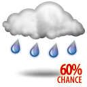







Memorial Day
Showers likely and possibly a thunderstorm before 10am, then a chance of showers between 10am and 11am. Patchy fog before noon. Otherwise, mostly cloudy, with a high near 74. Southwest wind around 5 mph becoming northwest in the afternoon. Chance of precipitation is 60%. New precipitation amounts between a tenth and quarter of an inch, except higher amounts possible in thunderstorms.
Tonight
Patchy fog after 2am. Otherwise, mostly cloudy, with a low around 54. Calm wind.
Tuesday
Patchy fog before 8am. Otherwise, mostly sunny, with a high near 82. Calm wind.
Tuesday Night
Partly cloudy, with a low around 60. Calm wind.
Wednesday
Mostly sunny, with a high near 85. Calm wind becoming west around 5 mph in the afternoon.
Wednesday Night
Mostly cloudy, with a low around 60.
Thursday
Sunny, with a high near 74.
Thursday Night
Mostly clear, with a low around 52.
Friday
Sunny, with a high near 76.
Friday Night
Partly cloudy, with a low around 52.
Saturday
Mostly sunny, with a high near 74.
Saturday Night
Partly cloudy, with a low around 50.
Sunday
Mostly sunny, with a high near 74.
Station Information
| City | Franklin |
| State | NJ |
| Alt. name | Franklin |
| County | Sussex |
| Elevation | |
| Wind Sensor Height | |
| Latitude | 41.1333333 |
| Longitude | -74.5786111 |
| Type | USGS_IV |
| Network | USGS |
| Heated Rain Gauge | No |
| Activation | |
| Deactivation |
Deployed Sensors
Latest Conditions

Wind
--
Wind Gust
--
| Now | This Hour | Last 6 hr | Today | Last 24 hr | ||||||
|---|---|---|---|---|---|---|---|---|---|---|
| Temperature | -- | -- | -- | -- | -- | -- | -- | -- | -- | |
| Heat Index | -- | -- | -- | -- | -- | -- | -- | -- | -- | |
| Dewpoint | -- | -- | -- | -- | -- | -- | -- | -- | -- | |
| Wind Speed/Gust | -- | -- | -- | -- | -- | -- | -- | -- | -- | |
| Precip | -- | -- | 0.19 | -- | 0.22 | |||||
Trends and Climatologies
Station Map
Station Photos