Flood

Talk of Drought Evaporates: May and Spring 2017 Recaps
June 5, 2017 - 4:19pm -- Dave Robinson

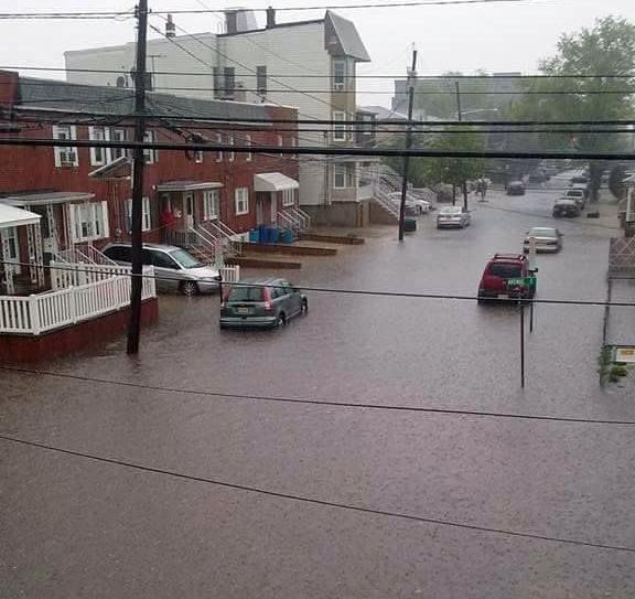
Bayonne street flooding

It is always comforting to enter the water demand season, namely summer, with a bit of a hydrological cushion. Such is the case this year across NJ, thanks to ample rain and some late-season snow in recent months. This timely precipitation has eliminated drought concerns that stemmed from drier-than-normal intervals during 2016. As a result of the precipitation deficits, ground water, streamflow, and reservoirs all dropped to precarious levels, thus the issuance last fall of a drought warning by the NJ Department of Environmental Protection over northern NJ and a drought watch in some southern counties. Aside from two reservoirs in west central NJ remaining below average, at the moment all other hydrological signs are positive. However, no one should let their guard down and fail to appreciate the finite nature of our fresh water resources, and how quickly a period of abundance can lapse again into drought.

More will be noted regarding spring (March–May) conditions later in this report. First taking a look at May, New Jersey experienced its 9th wettest on record, with observations extending back to 1895. The statewide average rainfall of 6.62” was 2.63” above the 1981–2010 average and the wettest May since 1990. Frequent clouds and rain resulted in many chilly days, however, a mid-month heat wave was impactful enough such that the average statewide temperature of 59.8° was only 0.7° below the 1981–2010 average. It was the 61st coolest May of the past 123 years, with none cooler since 2008.

A Return to Hot Julys After a Two-Year Respite; Awfully Wet Too: July 2016 Recap

August 3, 2016 - 5:01pm -- Dave Robinson

Flooding photo

The second half of the 2016 NJ weather and climate year began with plenty to talk about. Maximum temperatures were 90° or higher somewhere in the state on 20 afternoons. This, along with many warm nights, helped boost the mean monthly temperature into the top 10, based on statewide records back to 1895. Yet, remarkably, this was only NJ’s 5th warmest July in the past 11 years. The 77.2° mean was 2.2° above the 1981–2010 average.

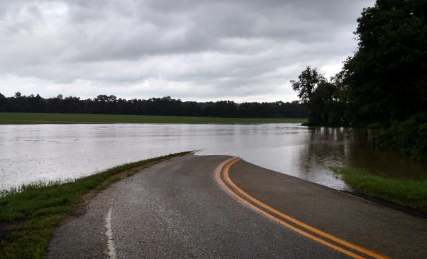
On 15 July days an inch or more of rain fell somewhere in NJ. This included eight days with greater than 2” in spots and four days where a few locations exceeded 4”. Statewide, the average rainfall was 6.85”. This was 2.33” above average and ranks as the 14th wettest July since 1895. It was the wettest July since 2004, and the 4th wettest in the past 41 years. The northern half of the state (Mercer/Somerset/Union northward) averaged 7.27” (+2.49”, 14th wettest), while the southern region averaged 6.77” (+2.38”, 12th wettest). This all came in a month where the northern half of the state remained classified as being in moderate drought (D1) on the US Drought Monitor, with about half of south Jersey considered abnormally dry (D0). Also, on July 26th the NJ Department of Environmental Protection placed the northern half of the state in a drought watch. These actions were the result of notable rainfall deficits dating back to the early spring, with the warmth of the month exasperating low soil moisture, stream flow, ground water, and reservoir conditions. Clearly, the late-month heavy rainfall in a good portion of the state warrants a re-evaluation of drought status as NJ heads into August.

Leaning Warm, Leaning Dry: July 2015 Recap

August 1, 2015 - 8:23pm -- Dave Robinson

Flooding photo

In most respects, July 2015 was a rather common one in the weather department. The statewide average temperature of 75.5° was 0.5° deg above the 1981–2010 mean. This past June had the same positive anomaly. This ranks as the 28th warmest July since 1895. It may seem strange to have such a small departure from normal yet rank in the top quartile for warmth. This can be explained by the fact that New Jersey has gotten warmer since the end of the 19th century. Compared to all Julys since 1895, this past July was 1.3° above average. Again, this might not seem like a large difference, however, given that temperatures do not vary from year to year nearly as much in summer as in winter, this change over the past century is notable.

Drought? What Drought?: June 2015 Recap

July 4, 2015 - 7:34pm -- Dave Robinson

Roll Cloud photo

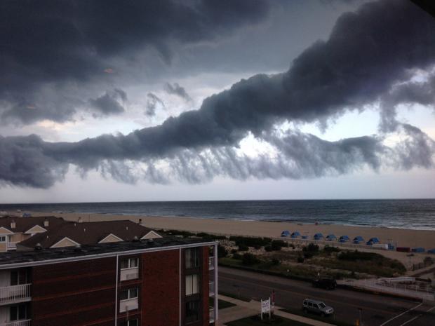
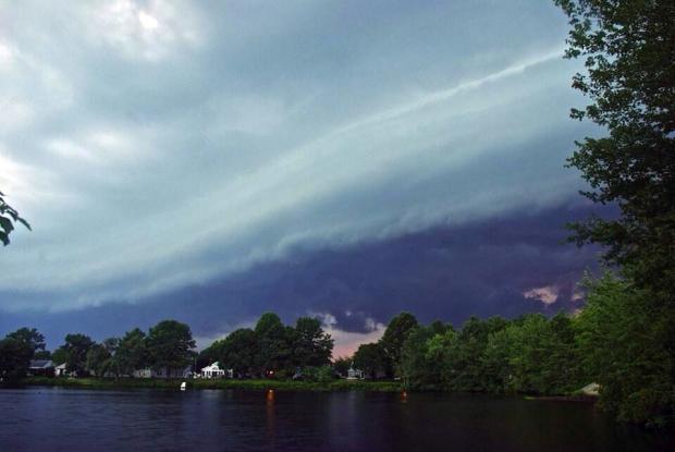
Toward the end of May, the threat of a significant drought loomed over the Garden State, as May proved to be the 3rd driest on record. Crops were in bad shape or not growing at all, and reservoir levels were declining at a faster than seasonal rate. However, New Jersey had yet to reach the point where average and timely rainfall could not remedy the situation. Not only was this prescription filled, it was done in abundance. June rainfall averaged 8.21" across NJ. This was 4.19" above the 1981-2010 normal and ranked 4th wettest since 1895 (Table 1). It joined four other Junes in the past 13 years to rank in the top eight over this 121-year period. As explained in last month's report, the rains that fell during the daytime and evening hours of May 31st factored into the June total, much as the localized afternoon and evening rains on June 30th (discussed below) will count toward the July total.

New Jersey Hurricane Hunting: A brief recap of a small state’s big hurricane history

August 21, 2014 - 1:35pm -- Tom Karmel

Doria flooding photo

With more than a third of the 2014 Atlantic hurricane season behind us, many may assume this season has been quiet. However, the two hurricanes already named mark the first time since 1992 when the first two named storms have reached hurricane strength and the first time there have been two hurricanes by this date since 2008. With the peak of the tropical season yet to come, the question is whether the heart of the season will be active or quiet. The National Weather Service’s Climate Prediction Center recently updated their seasonal forecast, projecting only a 5% chance of an active season and 70% chance of a less than normal one. Still, it only takes one storm to seriously impact NJ, so we can never let our guard down. With this in mind, here is a brief history of memorable tropical cyclones affecting New Jersey and a summary of the frequency of storms through the hurricane season.

Mid-Atlantic Deluge

August 13, 2014 - 5:40pm -- Dave Robinson

Rainfall estimate map

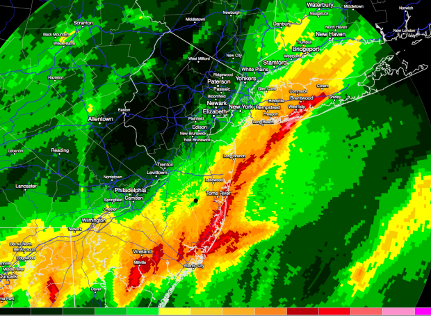
Extremely heavy rain drenched portions of the Mid-Atlantic during the daytime hours on August 12 until after sunrise on the 13th. Starting off in the Washington-Baltimore area and moving up into central Long Island, a narrow ribbon of rainfall exceeding 5”, and over 10” in a few locales, resulted in flash flooding that resulted in water rescues and many damaged roads and vehicles. Excessively heavy rains, occasionally accompanied by lightning, traveled up a frontal boundary that was associated with an unusually strong August low-pressure system situated over the Great Lakes. The atmospheric impulses riding up this front joined forces with abundant atmospheric moisture (in the top 1% for the region) to bring multiple inches per hour rainfall rates…for multiple hours.

The heaviest rain was situated within less than a 10-mile wide path. Within 20 miles on either side, totals fell off to a mere inch or two, or even less. Such is the nature of these events, where despite the abundant atmospheric moisture, there is a finite amount of water available. The dynamics concentrated the atmospheric lifting, thus the condensation of the majority of the moisture and resultant rainfall, while adjacent areas balanced out the lifted air with subsiding air that greatly limited rainfall totals.

A Rather Average July, Believe It or Not: July 2014 Summary

August 4, 2014 - 6:26pm -- Dave Robinson

Thunderstorm photo

Despite a general feeling amongst NJ residents that July 2014 was a cold summer month, in actuality, compared to long-term records, it was rather average. The statewide average temperature of 74.5° was 0.5° below the 1981-2010 mean. However, it was 0.3° above the 1895-present mean and ranked as the 45th warmest July of the past 119 years. Even the number of afternoons with temperatures of 90° or higher was close to normal. So why the common misperception? Some armchair psychology brings me to four possibilities:

1) The first half of the month was above average, while the more recent weeks were on the cool side. Our perceptions are biased toward the most recent.

2) People have yet to “recover" from the cold start of 2014. The dubious media ramblings of the “polar vortex" returning to the eastern US in mid-July fueled these thoughts.

3) The most recent four NJ Julys all rank in the top six for warmth over the past 119 years. This was an amazing run of hot Julys.

4) Those sticking their toes in the Jersey surf in early July were shocked by water temperatures in the 50°s and may have equated this to the cool July atmosphere. The cold surf was actually indicative of persistent southerly winds that brought atmospheric warmth. This wind flow led to coastal upwelling that pushed warmer surface waters offshore and introduced cool deeper waters to the surf zone.

On the Mild and Dry Side: June 2014 Summary and Mid-Year Recap

July 4, 2014 - 5:17pm -- Dave Robinson

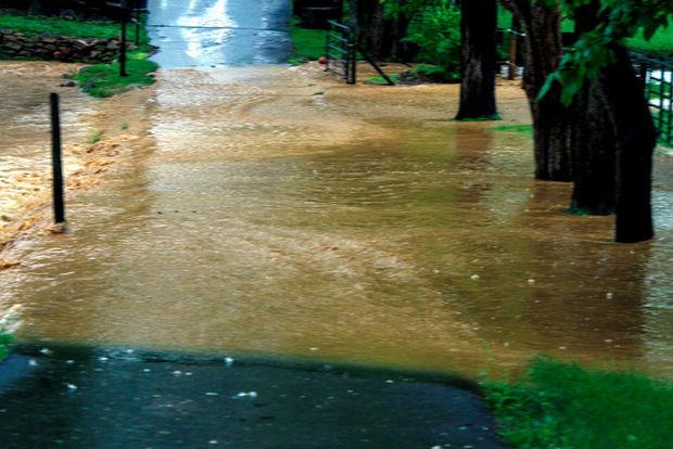
Flood photo in Stewartsville

Statewide, the first six months of 2014 averaged 45.8°. This is 2.2° below normal and ranks as the 31st coolest since 1895. It was the coolest start since 2003, which was 45.0° and ranked 15th. Before then you have to go back to 1982 (45.3°), which ranked 20th. The chilliest was 1907 at 43.2°.

Precipitation (rain and melted snow) averaged 24.76" across NJ from January through June. This total is 2.11" above normal and is 26th wettest. Since 2003, four January-June intervals have been wetter, including last year. 2011 ranked one notch drier at 27th. The wettest first half of the year was 1983 at 32.51".

A wet week: drenching rains and flash flooding visit opposite corners of the state

June 11, 2014 - 2:44pm -- Dan Zarrow

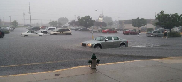
Photo of flash flooding in a parking lot

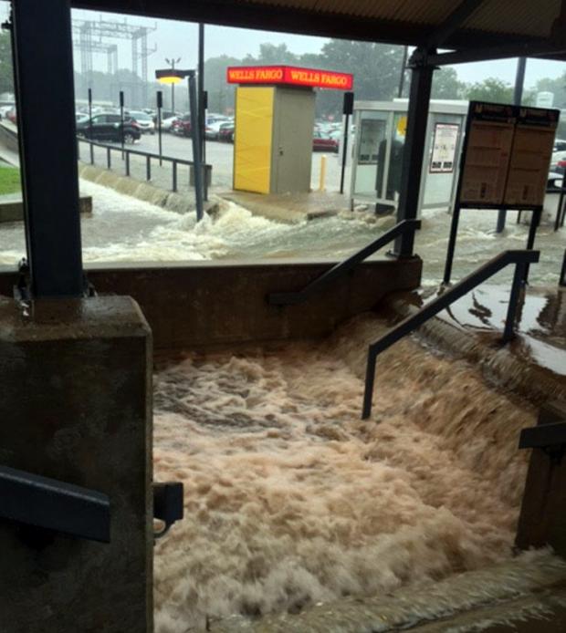
A steady stream of scattered showers and thunderstorms have brought heavy rain to several locations in New Jersey this week. And even more rain is in the forecast through the end of the week.

The deluge began on Monday morning, as commuters experienced periods of heavy, steady rain through parts of Mercer, Middlesex, Somerset, Union, Morris, Essex, and Bergen counties. The National Weather Service reported severe flash flooding in Newark, which required several motorists to be rescued.

Tuesday afternoon, another area of very heavy rain affected a narrow band in Camden, Gloucester, Burlington, and Atlantic counties. Rainfall estimates from the New Jersey Weather & Climate Network station in Sewell (Gloucester County) totaled almost 2 inches within just a half-hour from 4:30pm to 5:00pm on Tuesday. Widespread flash flooding, over a foot deep in spots, was reported to the National Weather Service by trained storm spotters and officials.

Typical Springtime Variability: May and Spring 2014 Summaries

June 7, 2014 - 1:01pm -- Dave Robinson

Flooding in Newark

May 2014 had a difficult time establishing an identity. What began with a storm that carried over from April 30th and resulted in the 7th largest flood of the past century in the Raritan basin on the 1st (see the April narrative for discussion of this event), later included some warm days, late freezes in a few locations, severe thunderstorms with hail in others, and a spectacular Memorial Day. Overall, May averaged 62.1°, which is 1.3° above average (compared to the 1981-2010 average). This ranks as the 35th warmest (tied with 1962) in the 120 years back to 1895. Precipitation averaged 5.18", which is 1.18" above average and ranks as 19th wettest. This value includes the considerable rain that fell on April 30th at National Weather Service Cooperative Stations that report during the morning hours (see April narrative for a full explanation).

Pages

Subscribe to RSS - Flood