For the 17th consecutive year, we in the state climate office have evaluated the myriad daily, monthly, and annual observations gathered across New Jersey during the course of the year to choose what we feel were the most significant and impactful 10 weather and climate events of 2025. More about each event can be found in the monthly narratives posted on our website. You might be tempted to rearrange the rankings, particularly as some of the events on the list may have affected you more than others ranked higher. Or perhaps you best recall one that didn't make the list. That's the enjoyment and frustration of lists! Unless stated otherwise, statewide values are based on an average of several dozen stations. The period of record for monthly, seasonal, and annual departures is 1991–2020; while for extremes and rankings it is from 1895–present. Observations are mainly drawn from National Weather Service Cooperative Observing Program stations, Rutgers NJ Weather Network (NJWxNet) stations, and NJ Community Collaborative Rain, Hail, and Snow Network (CoCoRaHS) locations.
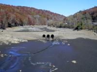
- Drought refused to disappear
- Statewide, 17 of the past 20 months dating back to May 2024 have had below-normal precipitation.
- 2025 preliminary statewide precipitation totaled 39.16”. This is 8.40” below normal and ranks as the 18th driest year on record.
- This was the driest year since 2001 and second driest since 1981.
- Amid the dry conditions, May was the 7th wettest on record. This and an above-average July found the statewide “Drought Warning” from the NJ Department of Environmental Protection (in place since November 13, 2024) reduced to a “Drought Watch” only in the Coastal South Drought Region on June 11th.
- A return of dry conditions led to the NJDEP expanding the “Drought Watch” to all the state on October 1st. This transitioned to a “Drought Warning” on December 5th.
- US Drought Monitor reported “Extreme Drought” (D3) in a portion of southern NJ through April 1st. Spring/summer improvements led to the short-term absence of “Abnormally Dry” or any “drought” category from July 15th to August 5th. Thereafter, conditions worsened, with “Severe Drought” conditions appearing in a portion of north Jersey on October 7th, and the year ending with 88% of the state ranging from “Abnormally Dry” (33%) to “Moderate Drought” (47%) to “Severe Drought” (8%).
- Deadly July storms
- July 3rd: Strong straight-line winds in Plainfield (Union County) and North Plainfield (Somerset) toppled trees, two of which fell onto cars resulting in the deaths of three individuals.
- July 8th: A golfer was struck and killed by lightning exiting a Sandyston (Sussex) course.
- July 14th: A deluge in the vicinity of the intersection of Union/Somerset/Middlesex counties deposited as much as 6.67” in Clark (Union) and 6.31” in Green Brook Township (Somerset). Flash flooding quickly ensued on local roads and streams. In Plainfield, the Green Brook rose 11.82 feet in less than three hours. Two individuals drowned in a vehicle in North Plainfield.
- July 16th: A lightning strike in Jackson Township (Ocean) resulted in one fatality and 14 injuries at an archery center.
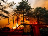
- Jones Road Wildfire
- April 22nd–May 12th mainly in Barnegat Township (Ocean).
- Fire consumed 15,300 acres, mostly in the first few days.
- Ongoing drought conditions contributed, though conditions on the 22nd were not at NWS “Red Flag” level.
- Came perilously close to invading local communities, with large evacuations.
- Fortunately, only limited damage to several buildings.
- Arrests were made for arson.
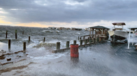
- Coastal flooding and storm conditions from a stalled early-season nor’easter
- Storm stalled off the mid-Atlantic coast from October 12th–14th.
- Notable flooding from five high tides over this period, especially in back-bay locations.
- Beach erosion occurred in many locations.
- Winds gusted to 40 mph or higher each day in coastal areas.
- From the 11th–15th, there were 46 hours at Harvey Cedars (Ocean) with gusts of 40 mph or greater.
- Rainfall totaled 4.08” in Brick Township (Ocean) and 3.82” at Toms River Township (Ocean).
- Late June heatwave
- June 23rd–25th saw multiple stations within the 69-station Rutgers NJ Weather Network (NJWxNet) reach the century mark.
- June 23rd: Seventeen stations topped out from 100°–101°, with Hackettstown (Warren), Hammonton (Atlantic), Lower Alloways Creek Township (Salem), Oswego Lake (Burlington), and Vineland (Cumberland) hottest at 101°. Harvey Cedars (Ocean) and Sea Girt (Monmouth) were least hot at 89°.
- June 24th: Thirty-seven stations from 100°–103°, with Hammonton, Toms River (Ocean) and Woodland Township (Burlington) reached 103°. Harvey Cedars, Vernon Township (Sussex), and High Point Monument (Sussex) were least hot at 93°.
- June 25th: Twelve stations from 100°–102°. Hammonton was 102°, High Point Monument was least hot at 89°.
- Coastal flooding associated with Hurricane Erin
- While never coming close to NJ, this massive storm generated high surf and coastal flooding from August 20th–23rd.
- Peak flooding with serious beach erosion occurred on the 21st when waters in Cape May Harbor reached the 4th highest level in at least 22 years.
- A warm year historically, but the coolest since 2014
- Annual: 53.7° (+0.1°). Ranked as the 21st warmest and least warm since 2014.
- Seasonal: 6th warmest spring (March–May).
- March–July averaged 62.3°, making this the 4th warmest such period, behind only 2010, 2012, and 2024.
- Seven months had above-normal temperatures, with three ranking in the top 10 for warmth: March was 10th warmest, June 9th, and July 5th. None of the five below-normal months were close to the top 10 on the cool side. The three coolest in terms of rankings were January 45th, August 37th, and December 39th.
- Windy episodes
- Wind gusted to 40 mph or greater at one or more of the NJWxNet stations on 99 days.
- January was tops with 16 days, followed by March with 14 days. February, April, November, and December ranged from 10–12 days.
- Includes eight days where 15 or more stations reached 40 mph. Top was February 16th with 39 stations, followed by December 19th with 35 and December 29th with 28.
- Five days saw one or more stations with 60–69 mph gusts. Six occurred on February 16th (top gust 68 mph), one on June 19th (61 mph), July 1st (64 mph), and July 25th (66 mph), and two on December 19th (top gust 63 mph).
- Thirty days had one or more station gust from 50–59 mph. Tops were seven on February 16th, six on both February 17th and December 19th, and five on both October 13th and December 29th.
- Odd locations of heaviest snow events
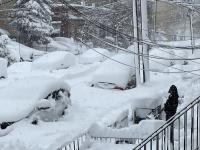
- Three 2025 storms deposited 8.0” or more at one or more NJ location.
- Two were in Cape May County (8.0” Wildwood Crest on January 6th and 8.8” in Cape May on February 11th–12th).
- One on December 13th–14th included a maximum of 8.5” in Howell (Monmouth), 8.0” in Jackson (Ocean), and 8.2” at Highland Lakes (Sussex).
- Another late end to the growing season in coastal and urban areas
- It was not until November 29th that four NJWxNet stations fell to the freezing mark this fall, including Atlantic City Marina (Atlantic), Little Egg Harbor Township (Ocean), Fortescue (Cumberland), and Lower Alloways Creek Township (Salem). This is generally a few weeks later than normal, though a day earlier than 2024.
- The first fall freeze at a NJWxNet station was in Walpack (Sussex) on October 2nd. This site had the shortest freeze-free growing season of 153 days (May 2nd–October 1st).
- The longest growing season was at Fortescue (Cumberland) lasting 269 days from March 5th–November 28th. This is 116 days longer than at Walpack.
- Last year’s numbers, while impressive, did not match this year’s, coming in at 165 days at Walpack on the short end and 250 days at Atlantic City Marina (Atlantic) on the long end, for an 85-day difference.
While not directly weather or climate related, weather conditions influenced viewing conditions:
- A solar storm brought a magnificent aurora borealis that was viewed by many across NJ on the evening of November 11th. Clouds obscured viewing in some locations.
- Second consecutive year for NJ viewing (along with October 10, 2024).


