Monthly Summaries

Seeking Identities:December 2022 and Annual 2022 Recaps

January 6, 2023 - 9:53pm -- Dave Robinson

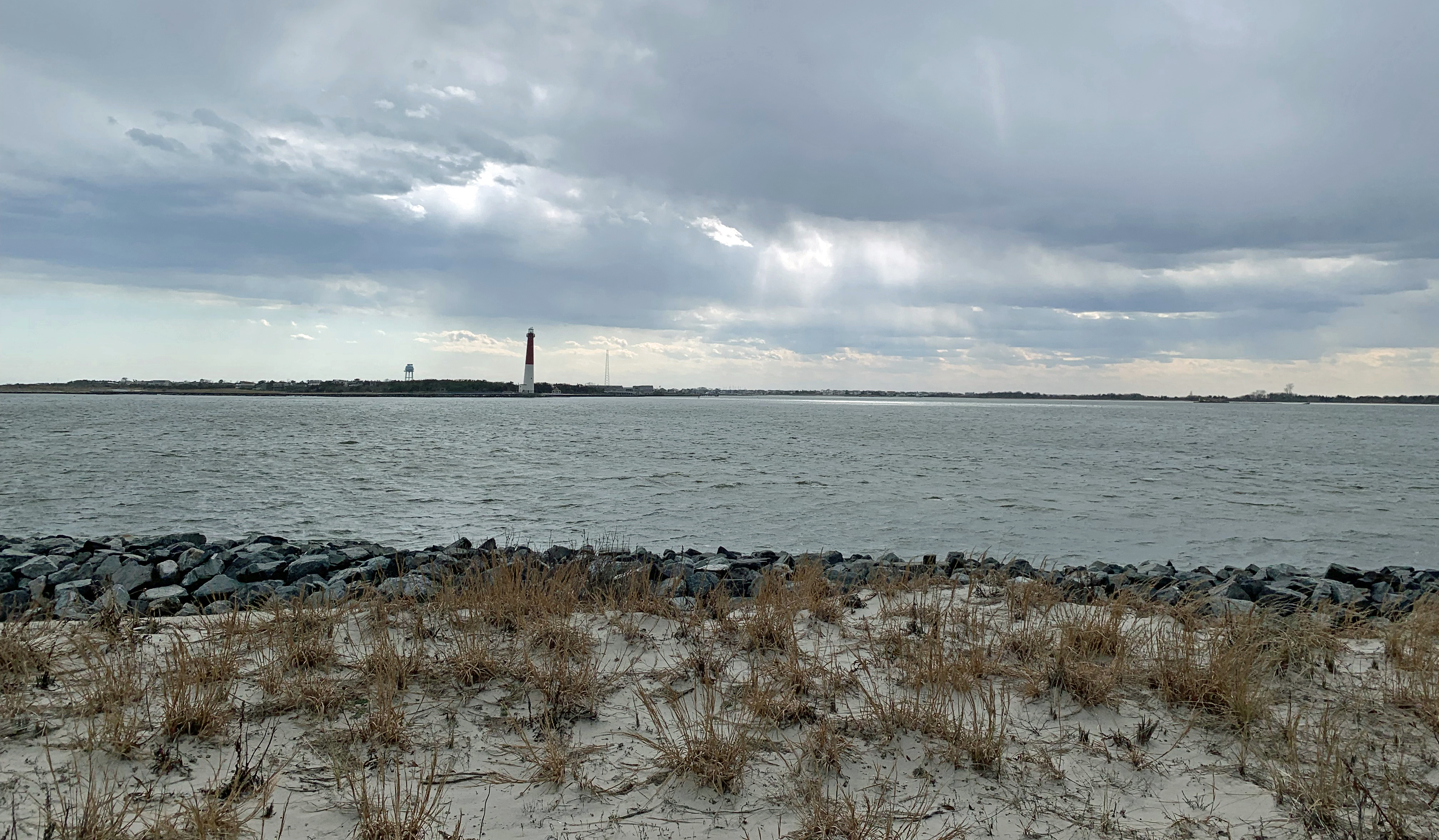
Strong winds push waves and spray onshore after a cold frontal passage on December 23rd in Seaside Heights (photo credit: Daniel Nee/Lavallette-Seaside Shorebeat).

As has so often been the situation in 2022, December’s weather never settled into any persistent pattern. Unless, of course, a pattern of frequent variations constitutes persistence! In any case, it seems appropriate to co-label this combined monthly and annual report as intervals in search of identities!

Looking first at December, the statewide average temperature of 35.5° is 1.1° below the 1991–2020 normal. This ranks as the 44th mildest December dating back to 1895. The statewide average maximum temperature of 44.9° is 0.1° below normal and ranked 31st mildest. The average minimum was 26.1°, which is 2.1° below normal and ranks 54th mildest. North Jersey averaged 33.3° (-0.8°, 36th mildest), south Jersey 36.8° (-1.3°, 49th mildest), and the Jersey coast 37.7° (-1.4°, 50th mildest).

Statewide precipitation averaged 4.76”, which is 0.49” above normal and ranks 35th wettest. North Jersey averaged 4.93” (+0.68”, 32nd wettest), south Jersey 4.68” (+0.40”, 37th wettest), and the Jersey coast 4.49” (+0.13”, 43rd wettest). The wettest locations were in the northeast and along the northern coast, while the northwest and much of the south were on the drier side.

A Tale of Two Novembers, and Leaning Warmer and Wetter Than Normal: November and Fall 2022 Recap

December 12, 2022 - 4:31pm -- Dave Robinson

An autumnal view along the Lamington River in Hacklebarney State Park on the border of Chester Twp. and Washington Twp. (Morris County). Photo by Dave Robinson.

Last month’s report spoke of how “classic” the weather was during October. November’s weather could be classified as being anything but such. The month began with perhaps the warmest first ten days of November on record in the Garden State, an interval that ranked up there with early November 2020. Then came winter-like temperatures for about ten days leading up to Thanksgiving before the month ended on a closer-to-normal note. There were only two mid-month events that brought more than an inch of rain to parts of the state, one associated with the remnants of a late-season hurricane that struck Florida. Portions of central and northern NJ saw the first snowflakes of the season during the cold spell, though aside from some minor accumulations at higher elevations, mostly traces were observed.

With the ups and downs of temperature, November came out averaging 47.5° for the state as a whole. This is 2.4° above the 1991–2020 normal and ties as the 15th mildest eleventh month on record. Ten of the twenty mildest Novembers since 1895 have occurred since 2001. The statewide average high temperature of 58.1° was 3.4° above normal, ranking 10th mildest. The average low of 36.9° was 1.4° above normal, ranking 20th mildest. North Jersey averaged 45.2° (+2.1, 15th mildest), south Jersey 48.7° (+2.4°, 17th mildest), and the Jersey coast 50.0° (+2.7°, 13th mildest).

Statewide precipitation averaged 3.08”, which is 0.28” below normal and ranks as the 63rd driest (66th wettest) on record. The north averaged 2.98” (-0.28”, 63rd driest), south 3.14” (-0.15”, 71st driest), and coast 3.14” (-0.20”, 68th driest). As the monthly map shows, central and northern coastal areas were wettest, while the driest areas were scattered in the far south, central, and north. It must be noted that the rain falling during the second half of the 30th is not included in the monthly totals for the state, regions, or individual stations presented later in the report. By convention, the reporting day for most National Weather Service (NWS) Cooperative and Community Collaborative Rain, Hail, and Snow Network (CoCoRaHS) stations used in this report ends at morning observation time on the last day of the month. Totals from the afternoon of the 30th, to be included in December totals, ranged as high as about an inch, though mainly 0.25”–1.00”.

Flipping the Seasonal Switch: September 2022 Recap

October 6, 2022 - 11:47am -- Dave Robinson

Low-lying radiation fog crossing the road in Sparta on the morning of September 24th.

Following a hot and dry summer, the questions of the day in September were when the temperature would begin to cool and would more abundant rainfall arrive. Signs of a rainfall resurgence were mixed, with drought conditions diminishing in spots but worsening in others. The temperature answer came in almost a flash on the 22nd (the first day of astronomical fall!) when a powerful cold front sent the thermometer quickly downward with an early-fall-like pattern arriving and remaining through month’s end.

September temperatures averaged 67.8° across NJ. This is 0.9° above the 1991–2020 normal and ties as the 22nd mildest September since statewide records commenced in 1895. The average high temperature was 78.2°, which is 1.0° above normal and tied for 23rd warmest. The average low was 57.3°, 0.7° above normal and ranking 23rd warmest. North Jersey came in at 65.7° (+0.8°, tied for 23rd warmest), the south 69.0° (+0.9°, tied for 21st warmest), and the coast 69.7° (+1.0°, 15th warmest).

NJ precipitation averaged 3.16” for September, which is 1.00” below normal and ranks as the 57th driest of the last 128 years. The north was wettest at 3.64”. This is 0.82” below normal, though ranks as just the 67th driest. The south came in with 2.86” (-1.13”, 51st driest) and the coast 2.98” (-0.91”, 57th driest).

Roasting: August 2022 Recap and Summer Overview

September 7, 2022 - 8:17pm -- Dave Robinson

The Great Swamp National Wildlife Refuge (Morris County) on August 24th. While August 22nd rain proved beneficial, the water level is normally higher. Photo taken by D. Robinson.

Much like this past July, August was a hotter and drier month than normal. Despite a June with rather close-to-normal numbers, the two most recent months brought the summer temperature and precipitation to top-10 levels for hot and dry conditions. More on summer ’22 later in this report, but first to discuss is a record hot and quite dry August.

The August average temperature of 77.4° was 3.8° above the 1991–2020 normal, ranking as the hottest on record. Eight of the ten warmest Augusts since 1895 have occurred since 2001. The average maximum of 88.5° was 4.7° above normal, the hottest on record, while the average minimum of 66.2° was 2.9° above normal, tied for 5th warmest. North Jersey averaged 75.7° (+3.8°, warmest on record), the south 78.4° (+3.8°, warmest on record), and the coast 77.9° (+3.2°, 3rd warmest).

Statewide, August precipitation averaged 2.61”, which is 1.96” below normal, ranking as the 22nd driest. The north came in at 2.31” (-2.25”, 18th driest), south 2.82” (-1.75”, 29th driest), and coast 2.54” (-2.06”, 25th driest). As the map shows, virtually the entire state had a monthly total below the statewide 4.57” normal. Exceptions were found in isolated west central and central coastal areas where several storms quickly deposited hefty totals. Less than half the normal monthly rainfall fell in a good portion of the north and in scattered areas of the south and north coast.

Once Again Hot, and This Time Around, Dry: July 2022 Recap

August 6, 2022 - 11:14am -- Dave Robinson

Trees and grass impacted by excessively dry conditions on Livingston Campus at Rutgers University in Piscataway (Middlesex County). Photo taken by D. Robinson on August 1st.

When it comes to recent hot Julys in New Jersey, the beat goes on. This year the heat was joined by quite limited precipitation, something not often seen in recent years. The statewide average temperature of 78.1° was 2.7° above the 1991–2020 normal, ranking 6th warmest since records commenced in 1895. Eight of the ten warmest Julys have occurred since 2010, leaving only 1955 and 1999 as top-ten outliers. The statewide average maximum was 88.6° (+2.9°, 6th warmest) and the minimum 67.5° (+2.4°, 4th warmest). Northern counties averaged 75.9° (+2.2°, 9th warmest), southern counties 79.5° (+3.0°, 3rd warmest), and coastal areas 78.8° (+2.6°, tied as 4th warmest).

Statewide July precipitation averaged 2.19”, which is 2.52” below normal, ranking as the 13th driest on record. Of the top 15, only two have occurred this century. The north averaged 2.03” (-2.69”, 14th driest), south 2.30” (-2.44”, 14th driest), and coast 2.16” (-2.22”, 17th driest). The central portion of the state was driest, with less than 2.00” accumulating, and under an inch in the driest areas. Closer-to-normal totals were found in the northwest, northeast, and southwest. At month’s end, portions of central NJ were classified as being in moderate drought (D1) on the weekly U.S. Drought Monitor map. This denotes conditions not seen more than once every five to ten years. Surrounding central and northern areas were considered abnormally dry (D0), as was the southeast corner of the state. This all coincides quite well with the most pronounced precipitation deficits of the past month.

Nondescript: June 2022 Recap

July 7, 2022 - 3:24pm -- Dave Robinson

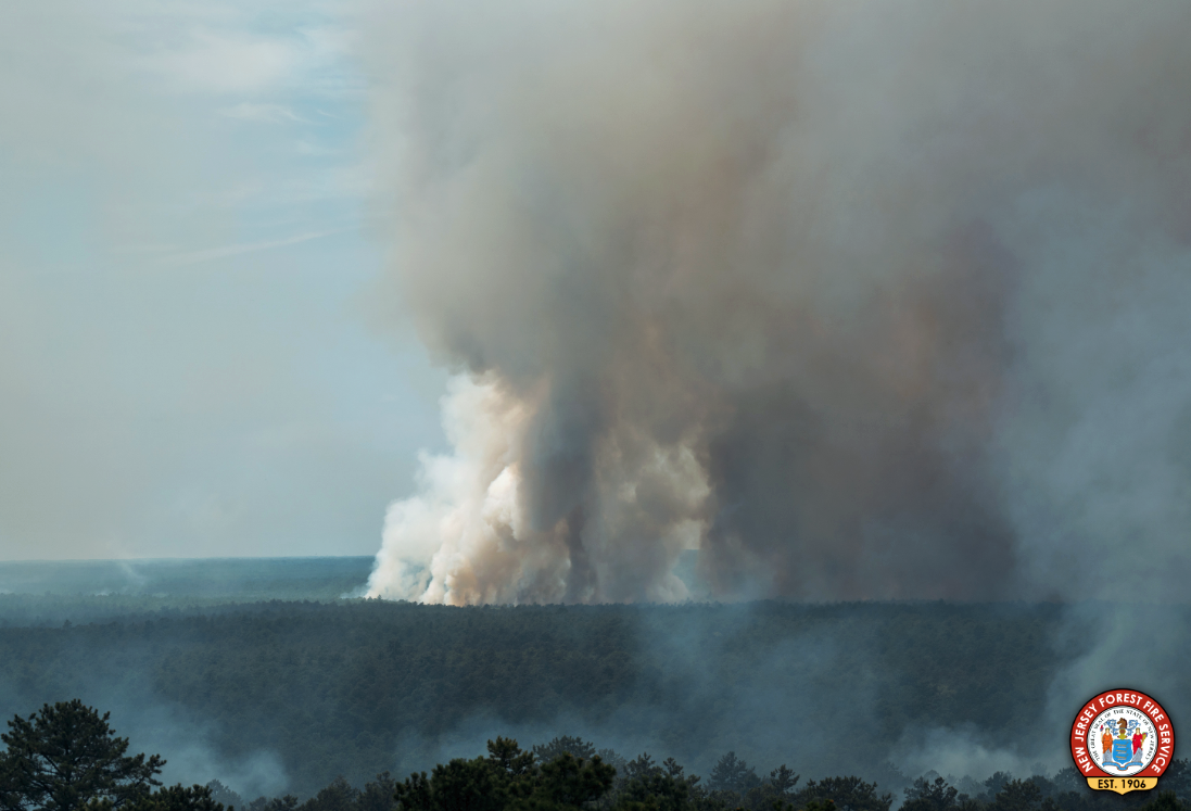
Smoke billows from a large wildfire in the Wharton State Forest around June 20th. Photo from the New Jersey Forest Fire Service.

As reported multiple times during the first half of 2022, the day-to-day weather and overall climate of the Garden State have varied frequently, exhibiting lots of variability and never “locking” into a given pattern for an extended period of several weeks or longer. Such was the case this June, making it difficult to define any conditions that dominated. June was somewhat drier than average, but eight events brought over an inch of rain somewhere within the state. It was also dry enough at one point for a wildfire to scorch over 13,000 acres of the Pine Barrens. Low temperatures fell into the upper 30°s and low 40°s at multiple locations on the 20th, yet three days earlier, the majority of the state saw highs in the low to middle 90°s. “Non-descript” seems the best way to sum things up.

Statewide, rainfall averaged 3.44”. This is 0.86” below the 1991–2020 normal and ranks as the 61st driest of the 128 Junes since 1895. The north received 3.59” (-1.02”, 61st driest), the south 3.39” (-0.75”, 61st driest), and coast 2.90” (-0.95”, 54th driest). As the map shows, the far south was driest, continuing a pattern seen in recent months. The June 30th U.S. Drought Monitor map has the bulk of the southern area seen on the Figure 1 map receiving less than 4.00” for the month classified as “Abnormally Dry” (D0). This rating is also a function of both low streamflow and ground water levels. Further north, pockets of above-average rainfall surrounded a below-average central region that has yet to have prolonged enough water deficits to qualify for D0 status.

Transition Complete: May and Spring 2022 Recaps

June 7, 2022 - 1:31pm -- Dave Robinson

Large hailstone from severe thunderstorm in Cherry Hill on May 20.

Many across NJ wondered if the incessant back and forth of weather conditions from early spring into May would ever cease and the more consistent warmth of late spring would arrive and persist. It took time this year, with a cool, damp start to May that included a nine-day interval of almost continuous onshore easterly flow. Come mid-month the seasonal transition was finally complete, and daytime highs mostly remained above 70° away from the coast and higher elevations. This included two episodes where temperatures exceeded 90°. Whether it was cool or warm, rainfall was rather plentiful through most of the month. Seven events produced an inch or more at multiple locations, two of which found some spots exceeding 3.00”.

The statewide average temperature was 63.3°. This is 2.1° over the 1991–2020 normal and ties as the 14th mildest May since 1895. The average maximum of 73.6° was 1.3° above normal and ranked 35th mildest while the average minimum of 53.0° was 2.8° above normal, ranking 7th mildest. Regionally, the north division came in at 62.0° (+2.1°, 15th mildest), the south 64.3° (+2.1°, tied with two others at 13th), and coast 62.4° (+1.4°, tied with one other at 20th).

Rainfall averaged 5.37” across NJ. This is 1.62” above normal and ranks as the 23rd wettest May of the past 128 years. Even with the Highlands being somewhat dry, the north was wettest at 5.98” (+1.96”, 18th wettest). The south averaged 5.03” (+1.43”, 25th), despite the far south being on the dry side. The coast came in with 4.77” (+1.26”, 26th).

Consistently Inconsistent: April 2022 Recap

May 7, 2022 - 11:00am -- Dave Robinson

Daffodils chat with each other in the foreground on April 16th in Franklin Twp. (Somerset County), as two others eavesdrop in the background along with one that couldn't care less.

As has been the case for the past several months, weather patterns have been reluctant to persist for more than several days to about a week. While climatologically rather common as winter transitions to summer, this season has seemingly been consistently inconsistent beyond the norm. April saw temperatures reach well into the 80°s on several days, followed a short time later by a hard freeze in most inland locations. Rainfall was above normal, more than twice so in the northwest, which is a reversal of the general pattern since late fall. Precipitation fell every few days, including multiple squally episodes that briefly delivered small hail, graupel, and bursts of snow at some locations. There was one event that brought some flash flooding and minor river flooding. Many residents are impatiently waiting for some mild conditions to lock in, getting summer underway. Patience….summer will arrive!

The good news is the rainfall that arrived quite often. Increasing concerns for drought encroaching on NJ were washed away by multiple storms that “performed” up to or exceeded expectations, something that was often not the case for multiple underperforming events in past months. Statewide rainfall averaged 5.10”. This is 1.40” above the 1991–2020 normal and ranks as the 24th wettest April since records commenced in 1895. As the monthly map shows, the northwest was wettest and south driest, yet still above normal. The north average 6.34” (+2.44”, 11th wettest), south 4.37” (+0.79”, 32nd wettest), and coast 4.09” (+0.54”, 42nd wettest).

Spring Foolery: March 2022 Recap

April 6, 2022 - 7:56pm -- Dave Robinson

Damaged magnolia flowers on March 29th at Rutgers University Livingston Campus in Piscataway

When it comes to shedding the winter coat and thinking of warm weather to come, March is known to have its early spring teases. Then, along comes some late winter cold to remind us winter is not quite ready to disappear. This spring foolery was on exceptional display this month. High temperatures jumped into the 70°s on the 6th and 7th, then back to the cold until the 70° mark was again eclipsed during four of the five days from the 15th–19th. Next came some more seasonable temperatures before a polar blast brought mid-winter frigid conditions from the 28th–30th, only to be followed by another day of 70°s to end the month. Interspersed with these wild fluctuations were episodes of thunderstorms, snow and rain, and 13 days where winds gusted to greater than 40 mph at some locations.

When all was said and done, the statewide average temperature of 43.6° was 2.6° above the 1991–2020 normal. This ranked as the 16th mildest March since 1895, with the end-of-month cold spell keeping the month out of the top 10 for warmth. The average maximum of 54.0° was 3.1° above normal, ranking 17th mildest. The average minimum of 33.3° was 2.1° above normal, also ranking 17th. The north averaged 41.1° (+2.3°, 21st warmest), south 45.3° (+2.9°, 15th), and coast 44.9° (+2.7°, 13th).

Precipitation averaged 2.72” across NJ, which was 1.48” below normal and ranks as the 26th driest March since 1895. The north caught 2.54” (-1.47”, 26th driest), south 2.80” (-1.52”, 30th), and coast 3.06” (-1.36”, 34th). In particular, a zone from Hunterdon to Bergen counties was driest and the coast from Atlantic to Monmouth counties was wettest.

Up, Down, Round and Round: February 2022 and Winter 2021/2022 Recaps

March 8, 2022 - 12:53pm -- Dave Robinson

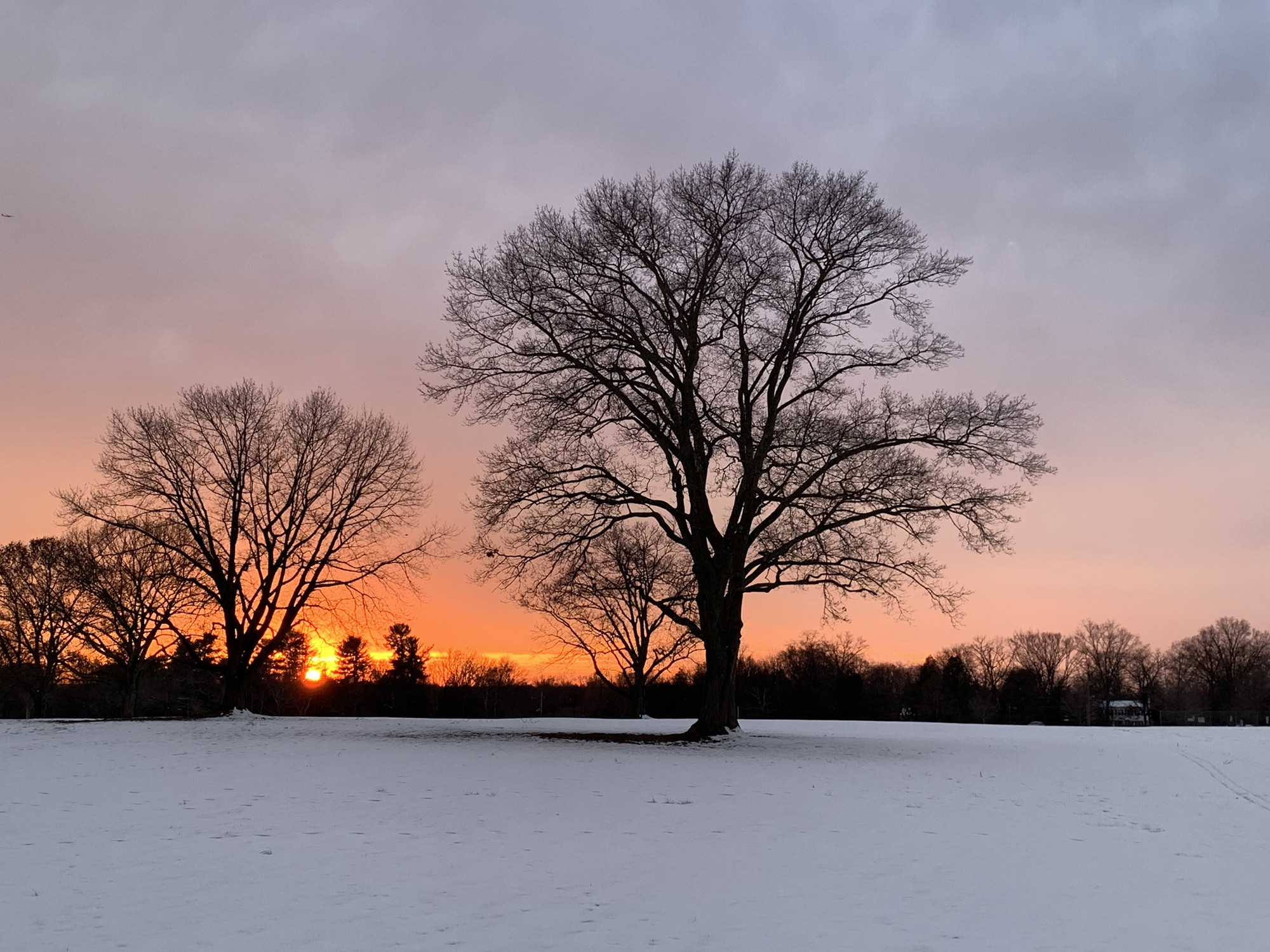
Sunset over a snow-covered field on February 14 at Colonial Park in Franklin Township (Somerset County).

The second month of 2022 and third month of winter continued a theme since December. Whether you call it a see saw, swing, or merry-go-round, it fits the theme of playground equipment as it never seemed any one particular variety of weather became established for all that long. More will be said about winter at the end of this report, but when it came to February, the end result was a somewhat warmer-than-normal month with about average precipitation and a dearth of snowfall. The statewide average temperature of 35.6° was 1.7° above the 1991–2020 normal, ranking as the 19th mildest since 1895. There was an above-average spread between the average high of 46.7° (+3.6°, 12th mildest) and low of 24.4° (-0.2°, 40th mildest), the 22.3-degree range being 3.8 degrees wider than normal. The north averaged 32.0° (+0.7°, 26th mildest), the south 37.7° (+2.2°, 16th mildest), and coast 37.9° (+1.9°, 18th mildest).

Rain and melted snow/sleet averaged 2.93”. This is 0.07” above normal and ranks as the 60th wettest/69th driest. The north averaged 3.45” (+0.66”, 44th wettest), south 2.62” (-0.27”, 49th driest), and coast 2.54” (-0.53”, 44th driest). More geographically specific, the far south was driest and the northwest wettest.

Pages

Subscribe to RSS - Monthly Summaries