Monthly Summaries

A Slow Green Up: April 2018 Summary

May 4, 2018 - 2:17pm -- Dave Robinson

Flash flooding photo

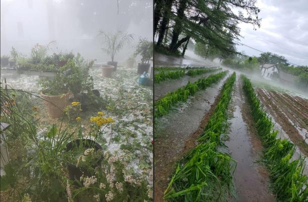
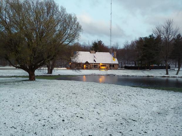
If you think it has been a long time since New Jersey experienced as chilly an April as this past one, you are correct. With snow accumulating in a storm on the 2nd to snow showers on the 30th, one was hard pressed to find many days when pleasant spring conditions could be found. Toss in two mid-month days when temperatures soared into the middle 80°s and another with strong thunderstorms delivering flash flood-producing rains, and weather-oriented heads kept spinning. However, overall, it was the persistent chill that captured the most attention, with the green up of lawns and foliage, accompanied by the blossoming of spring flowers, delayed from normal by upwards of two weeks.

Statewide, the April average temperature of 47.7° was 3.2° below the 1981–2010 mean (2.0° below the 1895–2017 mean). This ranks as the 28th coolest April since 1895 and the chilliest since 1982 (also 47.7°). The highest temperature observed in NJ was 87° at Stewartsville (Warren County) on the 14th and the coldest 16° at Walpack (Sussex) on the 11th.

April precipitation across NJ averaged 4.20”. This was 0.21” above the 1981–2010 mean (0.48” above the period-of-record mean). This was the 38th wettest April on record. Plentiful precipitation since February has eliminated drought concerns as we enter the summer water consumption season. Reservoirs and ground water levels are in good shape. However, this never means we should let our guard down and not use water in a responsible manner.

The Lion Roared All Month Long: March 2018 Summary

April 7, 2018 - 3:04pm -- Dave Robinson

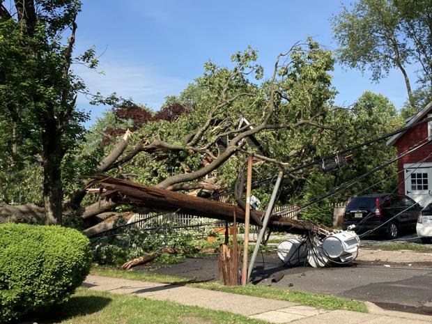
While the first and last few days of the month came in disguised as a lamb, March 2018 was a roaring lion on many occasions. Three nor’easters pounded New Jersey, with a fourth grazing the state, turning more of its wrath on southeastern New England. In true nor’easter fashion, the storms brought minor to moderate coastal flooding, significant beach erosion, powerful winds, heavy rain, and record- to near-record-breaking snowfall. This led to two of the larger power outages since Sandy in 2012, numerous traffic accidents, significant tree damage, frequent school closings, and even someone being injured by lightning during a snowstorm.

Plenty Dry with Backwards Warmth: September 2017 Summary

October 5, 2017 - 4:40pm -- Dave Robinson

Waves photo

While remarkable deadly and destructive hurricanes pummeled portions of the Caribbean and southern states, September weather conditions in the Garden State were generally quiet. The most notable exceptions were the dangerous rip currents at the Jersey shore associated with the latter stages of Hurricanes Irma and Jose, which resulted in several drowning deaths and numerous water rescues. Minor to some moderate back-bay flooding and beach erosion accompanied the tumultuous surf, particularly between the 18th–21st. Otherwise, little more than some clouds and light rain reached NJ from these storms, while earlier some remnant energy and moisture from Hurricane Harvey brought one of the month’s few notable rain episodes. Dry conditions prevailed through much of the September, especially the second half. As a result, statewide precipitation averaged just 2.23”. This is 1.82” below the 1981–2010 average and was the 28th driest September since 1895.

While the first half of the month had an average temperature of about a degree below normal, September finished on a warm note. Some locations experienced three consecutive days with maximums of 90° or higher from the 23rd–25th. This backwards turn to warmth while the calendar suggested there should be a decline in temperature resulted in the month averaging 2.6° above the long-term mark. The 68.4° average made this the 10th warmest September on record. The last three Septembers and six since 2005 all fall into the top 10.

The Weather Would Not Sit Still: January 2017 Recap

February 6, 2017 - 10:51pm -- Dave Robinson

Rough surf photo

A progressive weather pattern dating back to last fall continued to hold serve across the eastern US in January. This resulted in temperatures swinging between mild and cold levels and unsettled weather systems moving through often enough to bring precipitation levels close to average but, with one notable exception, not staying around too long to wreak havoc. Overall, it was a mild month, with a statewide average temperature of 36.2°, which is 5.5° above the 1981–2010 mean. This ranks as the 12th mildest January since 1895. It is interesting to note that while 10 of New Jersey’s warmest 15 years have occurred since 2000 and 14 of 15 since 1990, Januaries have not as often kicked off these warm years as much as one might imagine. Only 5 of the 15 mildest Januaries over the 123 year record have occurred since 2000 and just 8 of the 15 mildest since 1990.

A Rather Quiet End to the Year: December 2016 Recap and Annual Summary, including the Top 10 Events of 2016

January 4, 2017 - 3:40pm -- Dave Robinson

Snow photo

The atmosphere was in a progressive mode throughout December, which explains why no particular weather feature lingered in NJ or elsewhere across North America for too long. The seemingly day-to-day changes resulted in the statewide mean temperature of 36.4° being just 1.2° above the 1981–2010 normal. This ranks as the 28th mildest December since statewide records commenced in 1895, a far cry from last year’s record mild conditions. Despite there being seven precipitation events, one of which was mainly a carry over from November 30th, the rapid movement of these systems meant that none deposited prodigious totals in NJ. Thus 3.37” fell, which is 0.48” below average. This ranks as the 55th driest December. Monthly statewide snowfall averaged 2.0”. This is 2.1” below the 1981–2010 average and ranks 45th least snowy. The northern seven counties averaged 5.5”, the central six counties averaged 1.8”, and the eight southern counties 0.2”, all below average.

Gradual Seasonal Transition: November 2016 and Fall 2016 Recaps

December 8, 2016 - 1:51pm -- Dave Robinson

Snow photo

Much like the entire fall season, the transition into the cold half of the year was in no great hurry in November. Leaves dropped from ten days to two weeks later than normal, but eventually by the 28th the temperature fell to the freezing mark at West Cape May (Cape May County) and Newark Airport (Essex), these being the last locations in the state to experience their first freeze. A major exception to the slowly-transitioning pattern was the moderate high-elevation snowfall the weekend before Thanksgiving.

Drought conditions continued to be worrisome across the state, even spreading southwards. However, back-to-back heavy rainfall events on the 29th and 30th provided some replenishment to thirsty soils and began adding water to surface reservoirs across central and northern counties. It will be interesting to see if the atmospheric pattern change that delivered the late-month soakings is fleeting or will be longer lasting. Monthly precipitation (rain and melted snow) averaged 2.48” across NJ. This is 1.13” below the 1981–2010 average and is the 43rd driest November since 1895. It is worth noting that most of the National Weather Service stations that go into determining this average report in the morning. Thus the rain that fell later on the 30th is not factored into the monthly average; rather, it will be part of the December total. Snowfall averaged 0.4” for NJ but broken into regions amounted to 1.3” in the north, 0.1” central, and 0” south. The statewide total is average for Novembers between 1981–2010 but 0.7” below the 1894–present average.

A Climatological Potpourri: October 2016 Recap

November 9, 2016 - 2:21pm -- Dave Robinson

oradell reservoir

Season transitional months are often known for the wide swings in daily and weekly weather conditions. October 2016 did not disappoint when it came to exhibiting such variability. Moisture associated with a weakening hurricane to the south contributed to south Jersey’s heaviest rain event. A modest late-month storm brought the first frozen precipitation of the season to northern counties. Record warmth for so late in the season was part of a dry mid-month week. Halloween eve seeing the temperature touch 80° in some locations before a thunder-strewn frontal passage dropped temperatures to more seasonal temperatures for trick or treating.

Top Ten August for Heat and Dryness, Yet Another Hot Summer in the 2000s: August and Summer 2016 Recaps

September 6, 2016 - 10:40pm -- Dave Robinson

Beach photo

While above-average temperatures persisted from July into August, the precipitation regime did a 180° reversal between months. A 9th warmest July transitioned to a 2nd warmest August across the Garden State, based on records extending back to 1895. The 14th wettest July proved to be a hydrological blessing following the 20th driest June and preceding the 9th driest August. While August ended with most of New Jersey designated as “abnormally dry” and the northeast in “moderate drought” according to the US Drought Monitor, and north Jersey remained under a NJ Department of Environmental Protection “drought watch,” water supplies would have been in far worse shape come late summer had July been dry.

A Return to Hot Julys After a Two-Year Respite; Awfully Wet Too: July 2016 Recap

August 3, 2016 - 5:01pm -- Dave Robinson

Flooding photo

The second half of the 2016 NJ weather and climate year began with plenty to talk about. Maximum temperatures were 90° or higher somewhere in the state on 20 afternoons. This, along with many warm nights, helped boost the mean monthly temperature into the top 10, based on statewide records back to 1895. Yet, remarkably, this was only NJ’s 5th warmest July in the past 11 years. The 77.2° mean was 2.2° above the 1981–2010 average.

On 15 July days an inch or more of rain fell somewhere in NJ. This included eight days with greater than 2” in spots and four days where a few locations exceeded 4”. Statewide, the average rainfall was 6.85”. This was 2.33” above average and ranks as the 14th wettest July since 1895. It was the wettest July since 2004, and the 4th wettest in the past 41 years. The northern half of the state (Mercer/Somerset/Union northward) averaged 7.27” (+2.49”, 14th wettest), while the southern region averaged 6.77” (+2.38”, 12th wettest). This all came in a month where the northern half of the state remained classified as being in moderate drought (D1) on the US Drought Monitor, with about half of south Jersey considered abnormally dry (D0). Also, on July 26th the NJ Department of Environmental Protection placed the northern half of the state in a drought watch. These actions were the result of notable rainfall deficits dating back to the early spring, with the warmth of the month exasperating low soil moisture, stream flow, ground water, and reservoir conditions. Clearly, the late-month heavy rainfall in a good portion of the state warrants a re-evaluation of drought status as NJ heads into August.

Rather Dry, but Still Some Storms: June 2016 Recap

July 6, 2016 - 1:58pm -- Dave Robinson

Tipped helicopter

Despite some damaging storms impacting portions of New Jersey on several days and some localized deluges near month’s end, June rainfall came in well below average. The statewide average of 2.36” was 1.66” below the 1981–2010 average. This ranks as the 20th driest June since 1895. Northern and central counties were generally drier than those to the south. At month’s end, the counties from Hunterdon, Somerset, and northern Middlesex northward were classified as being in “moderate drought,” the D1 category on the US Drought Monitor. The counties to the south, through Ocean and Burlington, were in the Monitor’s “abnormally dry” D0 category. June stream flow, ground water, and precipitation levels were all well below average, while reservoir capacities in the north began to dip below average near the end of the month.

Temperatures began on the cool side, but the second half of the month was warm enough to bring the statewide average June temperature to 70.6°, which was 0.5° above average. This ranks as the 30th mildest June on record. There was one minimal heat wave at some inland lower-elevation locations, where temperatures climbed to 90° or higher from the 19th–22nd. However, no location exceeded 93° this month. The dry conditions helped to rid the atmosphere of the previous day’s warmth during the nighttime hours, thus temperatures of 45° or lower were observed in spots on seven mornings.

Pages

Subscribe to RSS - Monthly Summaries