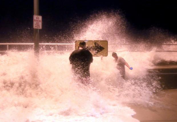
Large waves from Hurricane Jose crash over the seawall in North Wildwood (Cape May County) on September 19 (photo by Tim Hawk/NJ.com).
Overview
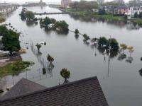
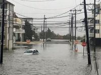
While remarkable deadly and destructive hurricanes pummeled portions of the Caribbean and southern states, September weather conditions in the Garden State were generally quiet. The most notable exceptions were the dangerous rip currents at the Jersey shore associated with the latter stages of Hurricanes Irma and Jose, which resulted in several drowning deaths and numerous water rescues. Minor to some moderate back-bay flooding and beach erosion accompanied the tumultuous surf, particularly between the 18th–21st. Otherwise, little more than some clouds and light rain reached NJ from these storms, while earlier some remnant energy and moisture from Hurricane Harvey brought one of the month’s few notable rain episodes. Dry conditions prevailed through much of the September, especially the second half. As a result, statewide precipitation averaged just 2.23”. This is 1.82” below the 1981–2010 average and was the 28th driest September since 1895.
While the first half of the month had an average temperature of about a degree below normal, September finished on a warm note. Some locations experienced three consecutive days with maximums of 90° or higher from the 23rd–25th. This backwards turn to warmth while the calendar suggested there should be a decline in temperature resulted in the month averaging 2.6° above the long-term mark. The 68.4° average made this the 10th warmest September on record (Table 1). The last three Septembers and six since 2005 all fall into the top 10.
| Rank | Year | Sept. Avg. Temp. |
|---|---|---|
| 1 | 1961 | 70.8° |
| 2 | 2015 | 70.7° |
| 3 | 2005 | 70.2° |
| 4 | 2016 | 69.6° |
| 5 | 1931 | 69.5° |
| 6 | 2010 | 69.2° |
| 7 | 1921 | 69.1° |
| 8 | 2011 | 68.9° |
| 9 | 1930 | 68.6° |
| 10 | 2017 | 68.4° |
Table 1. The ten warmest Septembers across NJ since 1895.
Temperature
Continuing with the theme of the previous paragraph, the first 13 days of the month only had one day where any of the 66 NJWxNet stations across the state reached 85°, while 11 of the final 17 days reached that mark. Meanwhile, 7 of the first 12 days saw a minimum temperature of 45° or lower at two or more stations, while that level of chill only returned during the last three days of the month.
The 5th was the lone early day with 85° warmth, as Hawthorne (Passaic County) climbed to 89° and Haworth (Bergen), Mansfield (Burlington), and Moorestown (Burlington) each reached 88°. The 14th saw Toms River (Ocean) reach 86° and Howell (Monmouth), Oswego Lake (Burlington), and Moorestown at 85°. Moorestown topped out at 87° and Hammonton (Atlantic), Pennsauken (Camden), and Mansfield 86° on the 15th. Cherry Hill (Camden) and Moorestown got to 89° on the 16th, with Sicklerville (Camden) and Pennsauken 88°.
The 20th began an eight-day stretch of 85° warmth, with Vineland (Cumberland) 87° and Logan, Sewell, and South Harrison, all in Gloucester County, at 86°. We welcome Vineland as the newest NJWxNet station, and thank its host, the Landis Sewage Authority. Vineland reached 88° on the 21st, with ten stations at 87°. Mansfield was 87° and Hamilton (Mercer) 86° on the 22nd. Wayne (Passaic) reached 91° on the 23rd, with Hamilton, Haworth, and Mansfield 90°. High Point Monument (Sussex) had the coolest high of 80° on the 23rd, with Walpack (Sussex) rising from a morning low of 47° to a maximum of 88°. The 24th was the apex of the late-season heat wave, with Hawthorne taking top honors at 95°, Wayne 94°, and 27 stations between 90°–92°. Harvey Cedars (Ocean) and Seaside Heights (Ocean), at 78° and 79°, respectively, were the only locations to top out below 80°. Hawthorne again was hottest at 94° on the 25th, with Stewartsville (Warren), Wayne, and Hamilton at 92°. Walpack reached 89° on the 26th, with Hawthorne and Pequest (Warren) at 88°, and the 27th saw Hawthorne get to 91° and Wayne 90°.
September began with two quite unseasonably cool mornings. The 1st found Walpack down to 36°, High Point Monument 41°, and High Point (Sussex) 43°. Walpack fell to a monthly low of 34° on the 2nd, as Basking Ridge (Somerset) and Pequest each reached 38°. Meanwhile 13 stations were 41°–45°, while the low at Atlantic City Marina (Atlantic) was a mild 61°. The 8th saw Pequest and Walpack at 43°, with the former 41° and latter 42° on the 9th. Walpack was 41°, Pequest 42°, and Basking Ridge 43° on the 10th, with Walpack at 38° and the latter two stations 39° on the 11th. Pequest and Basking Ridge were 44° on the 12th. Jumping to month’s end, Walpack fell to 44° on the 28th and 36° on the 29th, when Pequest was 40°. The 30th found Pequest at 41° and Walpack 42°.
Precipitation and Storms
The wettest locations in NJ this September came in close to the long-term statewide average, further illustrating the Jersey-wide dry conditions mentioned earlier in this report. Egg Harbor Township (Atlantic) topped the list with 4.58”, followed by Dennis Township (Cape May) at 4.23”, Estell Manor (Atlantic) 4.05”, Mansfield Township (Warren) 3.95”, Jefferson Township (Morris) 3.90”, and Galloway Township (Atlantic) 3.88”. Far drier were two stations in Ewing (Mercer) at 1.22” and 1.58”. Mt. Laurel (Burlington) caught only 1.23”, New Brunswick (Middlesex) 1.53”, Pitman (Gloucester) 1.55”, Lambertville (Hunterdon) 1.59”, and Plainsboro (Middlesex) 1.60”.
Spoiling the start of the Labor Day weekend, rain spread northward on the morning of the 2nd, not ending until early on the 3rd. The heaviest rain fell in Cape May and eastern Atlantic counties, and in the vicinity of Raritan Bay, with most of the state seeing at least 0.50”, and 51 of the 218 CoCoRaHS coming in at over an inch. Dennis Township took top honors with 2.11”, Egg Harbor Township saw 1.97”, Woodbridge (Middlesex) 1.82”, Ocean Township (Monmouth) 1.81”, Woodbine (Cape May) 1.73”, and 1.72” and 1.70” at two Middle Township (Cape May) locations.
The heaviest rain event of the month, and the last statewide soaking rain as of the date this report is published, was associated with the remnants of Hurricane Harvey, unnamed at the time it passed through this region. Rain began in the northwest portion of the state on the afternoon of the 5th, spread elsewhere in the evening and into the morning of the 6th, with thunderstorms scattered about, and ended by the predawn hours of the 7th. Most of NJ caught more than 0.50”, with 100 stations of the 223 with observations catching at least an inch. Coastal counties and portions of the northwest saw the inch plus totals, including Jefferson Township with 2.64”, Mansfield Township (Warren) 2.18”, Estell Manor 2.04”, Egg Harbor Township 1.91”, Port Republic (Atlantic) 1.88”, and West Milford (Passaic) 1.87”.
Scattered showers during the afternoon of the 13th delivered up to several tenths of an inch of rain to central counties. Hopewell (Mercer) received 0.49” and Lebanon (Hunterdon) 0.45”. Thundershowers invaded portions of the north on the afternoon of the 14th, with 0.65” in Hackettstown (Warren), 0.64” at Mt. Olive Township (Morris), and 0.34” in River Vale (Bergen). Once again, scattered afternoon showers brought some local downpours to portions of north central and west central NJ on the 16th. Morristown (Morris) was drenched with 2.05”, Florham Park (Morris) saw 1.45”, Woodland Park (Burlington) 0.97”, Flemington (Hunterdon) 0.95”, Chatham (Morris) 0.56”, and Hopewell Township (Mercer) 0.51”.
The 19th saw some two episodes of rain associated with the northwestern bands of Jose. Morning rain fell along the coast and evening rain occurred in the west. Colts Neck (Monmouth) and Point Pleasant Beach (Ocean), each with 0.64”, received the most, followed by Brielle (Monmouth) 0.59”, Brick (Ocean) 0.58”, and Estell Manor 0.56”. Most everywhere else saw less than 0.10”.
The 20th–29th period was almost rain-free throughout New Jersey, with only a few locations picking up a few hundredths of an inch in drizzle associated with fog. Widely scattered showers on the 30th deposited as much as 0.21” and 0.13” at two Washington Township (Morris) stations, 0.17” in Hackettstown, and 0.16” at Stafford Township (Ocean).
The highest barometric pressure of the month occurred on the 10th–11th, with readings of 30.35”–30.40”. The lowest readings were 29.70”–29.75” on the 5th, associated with Harvey’s remnants, and 29.65”–29.75” on the 28th, associated with the offshore remnants of Maria. There were only two days in the month where winds gusted above 40 mph at one of the NJWxNet stations. Harvey Cedars made it to 42 mph and Seaside Heights to 41 mph, with 11 other stations gusting between 30–36 mph on the 19th as Jose lingered well off the coast. High Point Monument gusted to 44 mph on the 28th as cooler high pressure advected into New Jersey, while Maria was well off shore.


