
Baked December 2015 and Annual Summary, Including the Top 10 Events of 2015
. Photo by Robyn Gerbush.")
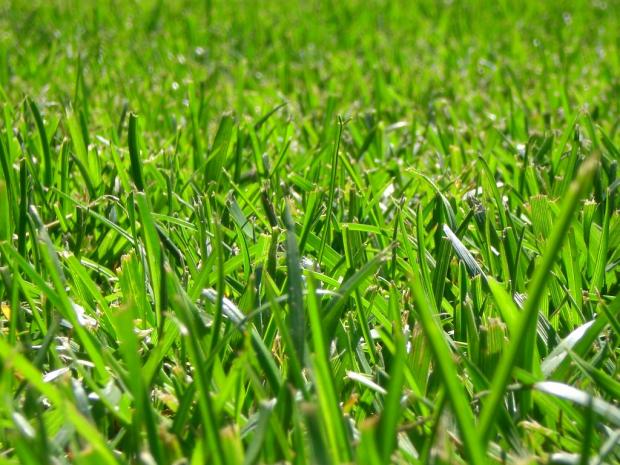
New Jersey residents will long remember the last month of 2015 as one where the grass remained green, weeds grew, and a few blossoms were seen on trees and shrubs. In fact, with an average temperature of 47.8°, it was the mildest December on record by a wide margin based on records dating back to 1895. Five of the 6 mildest Decembers have occurred since 2001. The anomaly of +12.2° exceeds the +11.0° value in January 1932 as the largest positive anomaly of any month on record. The 5.6° difference between this December's average and the second mildest in 2006 is by far the largest difference between first and second warmest values of any month. The second largest margin is 2.3° between October 2007 and 1971. With 121 years of records, the difference between one ranking and the next is often a tenth to a few tenths of a degree.
December precipitation averaged 4.91" statewide. This is 1.00" above normal and ranks as 27th wettest on record. Snow and sleet fell on one occasion, with light accumulations reported in the north. The statewide 0.1" snowfall average was 5.4" below normal. While certainly on the light side, this is not too out of the ordinary. Seven Decembers since 1895 have failed to see any snow accumulate, and 12 prior Decembers had a statewide average somewhere between 0.1" to 0.5".
 on Sunday, November 22nd. This was marveled at by many across NJ. Photo by Twitter user @CanoeCarnival.")
 on October 5. (Photo by Sharkey-Images).")
 on September 7. (Photo by B10 NJ Wildland Fire Page).")
 have been dropping steadily, leading to requests for voluntary water conservation (Photo by Tariq Zehawi/North Jersey Media Group)")
 on July 14. Photo by Layne Ball.")
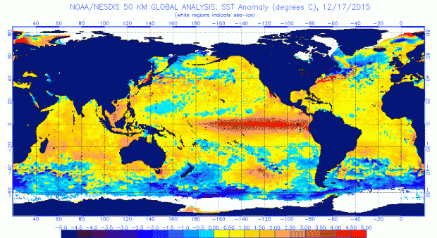
 anomalies for July 20, 2015. NOAA/NESDIS.")