Latest Temperatures

Current Dew Point

Latest Wind Speeds

Wind Gusts

Top Story

Ice-encased peach tree branches at 6:30 AM on April 8th.  Water was sprayed on the trees at the Stephen Specca Farms in Jacksonville (Springfield Township, Burlington County) to provide insulative ice cover, protecting the buds from temperatures that fell into the upper 20°s. Photo courtesy of D. Specca.
Ice-encased peach tree branches at 6:30 AM on April 8th. Water was sprayed on the trees at the Stephen Specca Farms in Jacksonville (Springfield Township, Burlington County) to provide insulative ice cover, protecting the buds from temperatures that fell into the upper 20°s. Photo courtesy of D. Specca.

April 2026 was a month ranking in the top ten for warmth, yet the major weather news of the month was a damaging late-month freeze. Weeks vacillated between warmth and cold, with the warm ones winning out. This thermal whiplash was accompanied by yet another below-normal month of precipitation, making this 21 of the past 24 months with below-normal totals across the Garden State. A Drought Warning issued by the NJ Department of Environmental Protection remains in place.

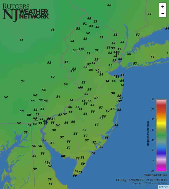
The 54.4° average April temperature is 2.9° above the 1991–2020 normal. This ties as the 6th mildest since records commenced in 1895. Seven of the ten mildest Aprils have occurred since 2002, with 2006 (12th) and 2025 (13th) not far behind. The average high of 66.4° is 3.7° above normal, ranking 6th mildest, and the average low of 42.4° is 2.1° above normal, ranking 7th mildest. The northern climate division averaged 52.9° (+3.0°, 6th mildest), the southern division 55.5° (+2.9, 6th mildest), and the coastal division 54.2° (+2.5°, 8th mildest).

April precipitation averaged 2.51” across NJ. This is 1.19” below normal and ranks as the 23rd driest. The northern division averaged 2.84” (-1.06”, 39th driest), southern 2.31” (-1.27”, 18th driest), and coastal 2.33” (-1.22”, 25th driest). Northwest areas were closest to normal, with west central and far southern reaches driest. Only trace amounts of snow and sleet were observed in several locations during the month.

Latest Extremes

City, State Temp
Fortescue, NJ 62
Mannington Twp., NJ 61
Greenwich, NJ 61
Vineland, NJ 61
Lower Alloways Creek, NJ 61
City, State Temp
High Point Monument, NJ 51
High Point, NJ 52
Wantage, NJ 54
Chester Borough, NJ 54
Hackettstown, NJ 54
most current information as of May 24 7:55 PM

Latest Conditions & Forecast

New Brunswick, NJ

Rutgers University Meteorology Program

57°F

Wind

2 mph from the NNE

Wind Gust

8 mph from the NNE

Patchy Fog then Chance Showers and Patchy Fog
55 °F
Showers and Patchy Fog then Chance Showers
74 °F
Mostly Cloudy
59 °F
Decreasing Clouds
81 °F
Mostly Cloudy
62 °F
Partly Sunny
85 °F
Mostly Cloudy
65 °F
Mostly Sunny
81 °F
Mostly Clear
57 °F
Sunny
78 °F
Mostly Clear
56 °F
Mostly Sunny
77 °F
Partly Cloudy
56 °F
Partly Sunny
74 °F

Tonight

A chance of showers, mainly after 5am. Patchy fog after 8pm. Otherwise, cloudy, with a low around 55. Northeast wind around 5 mph becoming calm after midnight. Chance of precipitation is 30%. New precipitation amounts of less than a tenth of an inch possible.

Memorial Day

Showers, mainly before noon. Patchy fog before 9am. High near 74. Calm wind becoming west around 5 mph in the afternoon. Chance of precipitation is 80%. New precipitation amounts between a quarter and half of an inch possible.

Monday Night

Mostly cloudy, with a low around 59. Southwest wind around 5 mph becoming calm.

Tuesday

Cloudy, then gradually becoming mostly sunny, with a high near 81. Northeast wind around 5 mph becoming southeast in the afternoon.

Tuesday Night

Mostly cloudy, with a low around 62. Southwest wind around 5 mph.

Wednesday

Partly sunny, with a high near 85.

Wednesday Night

Mostly cloudy, with a low around 65.

Thursday

Mostly sunny, with a high near 81.

Thursday Night

Mostly clear, with a low around 57.

Friday

Sunny, with a high near 78.

Friday Night

Mostly clear, with a low around 56.

Saturday

Mostly sunny, with a high near 77.

Saturday Night

Partly cloudy, with a low around 56.

Sunday

Partly sunny, with a high near 74.

Search by zipcode or city/state for the latest conditions, forecasts, graphs, maps and more nearest to you.

More News

Low clouds hover over Atlantic City as seen from the Forsythe Wildlife Refuge in Galloway Township (Atlantic County) on March 6th. Photo by Dave Robinson.

As is common as winter transitions into spring, this weather/climate shift came in fits and starts this March. Included were some rapid thermal flips, occasional powerful winds, and enough rain in the north to ease drought concerns but well below-normal rain in the south, a region that during winter had been leading the way with beneficial precipitation. The only thing mostly missing, for the third consecutive March, was snowfall, as the persistent snow and ice cover of recent months quickly melted. With a statewide ranking of 12th warmest, March 2026 is the eighth over the past 26 years...

A snowy scene in Jersey City (Hudson County) during the afternoon of February 23rd towards the end of major winter storm.

The adage “wash, rinse, repeat” is an appropriate one when reviewing New Jersey’s weather and climate conditions over this past winter. There were multiple snowstorms and cold spells throughout the season, with below-normal precipitation (rain and melted snow/sleet) in each month as the state continues to experience drought conditions that date back almost two years. All this will be covered in a seasonal overview later in this report. First, a recap of conditions in a February that exemplifies what all months experienced this past winter. The statewide February temperature averaged 29.6...

A frozen Navesink River resulting from cold conditions in January allowed for winter recreation, including ice boating by the North Shrewsbury Ice Boat and Yacht Club on February 1st. Photo by Brian Donohue.

Following a cold December and first few days of the month, temperatures rose to above-normal levels through the remainder of the first half of January. Thereafter, a major mid-month atmospheric pattern shift brought Arctic air roaring into the region, and with it several snow events and one of the more persistent cold episodes in recent years lasting through the end of the month. The first 15 days of January averaged 13° milder than the final 16 days. All told, the statewide January average temperature of 28.0° was 3.7° below the 1991–2020 normal. It ranked as the 42nd coldest since NJ...

More News

A Dud: 2019/2020 Snow Season Recap

April 28, 2020 - 6:14pm -- Dave Robinson

2019/20 season snowfall map

As we gradually transition into warmer spring temperatures, it’s a good time to recap what was a disappointing season for snow lovers, along with snowplow drivers, auto body repair people, and others who profit from snowy winters.

Seasonal snow totaled 4.7” averaged across the state. This is 19.2” below the 1981–2010 average and, looking back from the 1896/96 to 2018/19 snow seasons, is 21.4” below average. This ranks as the third least-snowy winter snow season, only behind the winters of 1972/73 and 1918/19.

Spring Ahead: March 2020 Recap

April 7, 2020 - 11:40am -- Dave Robinson

March 2020 was the 6th mildest in New Jersey dating back to 1895. Combined with mild rankings of 9th in January and 4th in February, 2020 has started off as the 2nd mildest on record at 5.8° above the 1981–2010 average. The 40.8° average only falls behind 2012’s 41.4°. Six of the ten mildest January–March intervals in the past 126 years have occurred since 2002.

March averaged 46.3° across NJ, which is 5.5° above average. The average maximum of 56.2° (+5.4°) ranked 7th mildest and the minimum of 36.4° (+5.6°) 2nd mildest. Anomalies were +5.8° in both the southern (47.9°) and coastal (47.7°) divisions, ranking 6th and 4th mildest, respectively, and +5.0° in the north (43.7°), ranking 9th mildest. As a result of the premature warmth, vegetation green up across the state was at least two weeks earlier than normal.

Exploring NJWxNet Solar Radiation Observations

March 20, 2020 - 11:52am -- Rohan Jain

Solar panels photo

Serving a wealth of potential user needs, solar radiation is one of the many variables observed at stations within the Rutgers NJ Weather Network (NJWxNet). Dating back as far as 2004, the original solar network of a half dozen stations has grown to the current 46. The solar instruments record incoming radiative fluxes in the 0.36 to 1.12 micron range. A myriad of products stem from observations, initially gathered once each hour and, since mid-2012, every five minutes. These include radiation maximums, averages, minimums (W/m²), and totals (kJ/m²), at five minute, hourly, and daily time scales.

Solar data gathered at NJWxNet sites help promote an understanding of the relationship between solar radiation and terrestrial systems involving the heating of the surface and atmosphere, plant growth, human health, and energy generation. Atmospheric conditions influence the magnitude of irradiance reaching the surface, with variables such as cloud cover, humidity, and aerosols (minute natural and human-generated liquid or solid particles) influencing incoming radiation. Prior to the advent of the NJWxNet, solar radiation observations across the Garden State were few in number and most often not of a continuous long-term nature. This was the case elsewhere in the US prior to the recent establishment of mesonets, such as the NJWxNet, in many states.

More Like Virginia: February 2020 and Winter 2019/20 Recaps

March 3, 2020 - 10:57pm -- Dave Robinson

Controlled burn smoke photo

Following on the heels of the 8th mildest January on record, February 2020 entered the books as the 3rd mildest since records began in 1895. The 39.2° average was 5.7° above the 1981–2010 mean. The northern climate division of the state averaged 36.2° (+5.2°; 6th mildest), the south was 41.0° (+6.1°; 3rd mildest), and the coastal division was 41.2° (+5.7°; 3rd mildest). Average minimum temperatures ranked 2nd mildest for the state, while average maximums ranked 8th mildest. To place February 2020 in some perspective, it was just 1.6° below the 1981–2010 March average of 40.8° and only 0.2° below the longer 1895–2019 March average. It was close to the long-term (1981–2010) average February temperatures in Washington, DC, Paducah, KY, and Bristol, TN.

February precipitation (rain and melted snow) came in very close to the 1981–2010 average at 2.82”. This is just 0.02” above average and ranks as the 62nd driest (and 65th wettest) of the past 126 years. Divisional totals ranged from 2.48” (-0.34”, 49th driest) in the north, 2.99” (+0.21”, 60th wettest) in the south, and 3.37” (+0.48”, 51st wettest) at the coast.

Where is Winter?: January 2020 Recap

February 4, 2020 - 2:01pm -- Dave Robinson

Boardwalk photo

The new decade got off on a rather unwintry note, with January temperatures well above average, snow rarely falling, and just one significant storm that brought only rain. The statewide average temperature of 37.3° was 6.6° above the 1981–2010 mean. This ranks as the 8th mildest January (tied with 1933) since records commenced in 1895. Anomalies and rankings were quite similar across the state. January 2020 was milder than December 2019 by 1.0°. The last time this climatological flip occurred was in December 2005/January 2006. Most notably, January 11th and 12th saw record daily temperatures in the upper 60°s to as high as 70°.

Precipitation fell mostly in the form of rain and mainly on the 25th. The monthly average across NJ was 2.38”. This is 1.02” below the mean and ranks as the 26th driest. The north was 1.27” below average, the south -0.84”, and the coast -1.12”, with all divisional totals between 2.14”–2.55”.

Winter Arrives Up North, Not So Much in the South, and Another Mild and Wet Year: December and 2019 Annual Recaps, Including Top 10 Events

January 7, 2020 - 5:22pm -- Dave Robinson

Freezing rain photo

There were multiple faces to December weather around the Garden State. Regionally, the north received above-average snowfall, several episodes of freezing rain, and over two weeks of snow cover, particularly at higher elevations. Central and southern areas saw less snow than average and temperatures a little milder than normal compared to up north. There was also a notable difference between the first and second halves of the month, with the first being stormy and the second having just one storm.

Despite a wintry start to the month, the statewide average temperature of 36.3° was 1.1° above the 1981–2010 normal and ranks as the 29th mildest since 1895 (tied with 2016). The north portion of the state averaged 33.1° (+0.4°), the south 38.2° (+1.6°), and the coast 39.4° (+1.7°). Despite a rather dry second half, the 5.56” of rain and melted snowfall averaged across the state was 1.71” above average, ranking as the 19th wettest (tied with 2012). The coast was wettest, averaging 6.09” (+2.33”), followed by the south with 5.60” (+1.81”), and then the north with 5.44” (+1.49”). Snowfall averaged 3.2”, which was 1.6” below average. The north came in with 8.0”, or 1.4” more than average, while the central area had 3.4” (-2.0”) and the south 0.5” (-3.1”).

Cold and Dry (A Rarity of Late), and Quite the Transition Season: November and Fall 2019 Recaps

December 5, 2019 - 5:28pm -- Dave Robinson

Leaf bags

In what has been a monthly see-saw of an autumn in the precipitation department (more below), November totals were on the low side. The statewide average total of 1.83” was 1.78” below the 1981–2010 mean. This ranked as the 22nd driest November since 1895. The northern half of the state averaged 2.31”, which is 1.55” below normal and ranks 31st driest. The south was drier at 1.54”, which is 1.91” below normal and ties with 1991 as the 18th driest. Temperature-wise it was the coldest month compared to normal since last November and, along with March, only the second below average one since then. The statewide average temperature of 41.3° was 3.9° below normal and ranks as the 27th coldest (tied with 1920 and 1955) of the past 125 Novembers. The north average 38.9°, which is 4.2° below normal and ties with six other years as the 24th coolest. The south averaged 42.6°, which is 3.8° below normal and ties with 1954 and 1972 as 27th coolest. Of late, there have been warmer and drier months compared to the norm, such as this past September and colder and wetter months including this past March. However, the last time New Jersey experienced a noteworthy dry and cold month (of any month) was November 2012 when the statewide average temperature was 3.7° below average and the precipitation 2.31” below average.

So Much for a Flash Drought: October 2019 Recap

November 6, 2019 - 2:33pm -- Dave Robinson

As the 10th month of 2019 commenced, attention was on the continuing flash drought conditions across the Garden State. Lawns had gone brown and shallow rooted trees were losing their dull-colored leaves early. By the second week of the month, the US Drought Monitor showed all of NJ to be in either abnormally dry (D0) or moderate drought (D1) status (full disclosure: my recommendations are taken under consideration by the national author of each week’s map). Several rain episodes in the first half of the month, particularly in the north, began to stall any worsening of conditions. However, it wasn’t until the last half that five events deposited an inch or more, three of them with two inches or more, at a number of locations around the state. Thus by month’s end, only portions of southwest, southeast, and central NJ were rated D0, and the remainder, as we like to say, in “D nada.” This turn to storminess didn’t come without consequences. This included localized flash and small stream flooding on occasion, several episodes of strong winds, and some minor to moderate coastal flooding. More on all of this below, but first to further summarize the month. In the precipitation department, the statewide average was 5.79”. This is 1.90” above the 1981–2010 normal and ranks as the 15th wettest dating back to 1895. North Jersey came in with an average of 6.72”, some 2.41” above normal and ranking 10th wettest. In the south, the 5.28” average was 1.65” above normal and ranks as the 20th wettest.

As if the wet month was not newsworthy enough, the statewide monthly temperature of 58.0° tied with two other years as the 9th warmest back to 1895. This is 3.5° above normal, with northern and southern portions coming in at 3.2° and 3.8° above, respectively. The 2nd was arguably the hottest October day on record, thus also the warmest for so late in the season. Meanwhile, several locations experienced the first freeze of the season on the 4th or 5th, with a more widespread frost and freeze on the 19th. Still, the month ended with only 18 of the 63 NJWxNet stations having fallen to the freezing mark.

Off Goes the Faucet: September 2019 Recap

October 7, 2019 - 5:26pm -- Mathieu Gerbush

Drought photo

No months prior to this past September have been drier across New Jersey since February 2009, a testament to how precipitation has leaned toward the wet side since the last major drought impacted the state in 2002. The 1.21” received this September was 2.84” below the 1981–2010 average. This ranked as the 7th driest September since records commenced in 1895. February 2009 saw only 0.66”, but since February is on average the driest month of the year (2.80”), the last time a monthly deficit was larger than this September was the 3.06” departure in September 2007. Since 2000, only six other months early in the century have been drier (February 2002: 0.75”, October 2000: 0.77”, March 2006: 0.82”, October 2001: 0.93”, November 2001: 1.00”, and September 2005: 1.19”).

Conditions were driest in the north, averaging 1.06”, which is 3.41” below normal and ranks as the 4th driest September on record. Southern NJ ranked 12th driest with 1.30”, which is 2.52” below normal. This “flash drought” depleted soil moisture, resulting in brown lawns and shallow-rooted trees losing leaves early. Fire danger also increased, resulting in a ban on open fires. At month’s end, the US Drought Monitor had most of NJ in the D0 (abnormally dry) category, with Salem County experiencing moderate drought (D1) conditions. Thanks to above-average precipitation earlier this year, northern NJ reservoir levels remained above early-fall averages. Certainly, a watchful eye will be kept on all water resources should this dry spell continue.

Above-average temperatures helped to dry things out in September. The 69.1° statewide average was 3.3° above the 1981–2010 mean. This ranks as the 8th warmest September over the past 125 years (tied with 1921; Table 2). Southern areas were warmest, at 3.5° above normal, while the north was 2.8° above.

Leaning Warm and a Bit Dry, and Once Again, Top-Ten Warmth: August and Summer 2019 Recaps

September 6, 2019 - 2:03pm -- Dave Robinson

Flash flood photo

The summer of 2019 concluded on a warm and a bit dry note when averaged across the Garden State. The warmth was a common theme throughout June to August, while the earlier summer months were on the wet side. The average August temperature of 74.4° was 1.4° above the 1981–2010 mean and is tied with 1983 and 1973 as the 14th warmest since 1895. On 12 days, the temperature topped out at 90° or hotter at one or more Rutgers NJ Weather Network station, but never exceeded 96°. The heat was somewhat tempered by seven mornings with lows in the 40°s at some northwestern NJWxNet locations.

August precipitation averaged 3.75” across NJ. This was 0.35” below normal and ranks as the 52nd driest of the past 125 Augusts. As expected during a summer month that is dominated by hit and miss showers, rainfall totals varied quite a bit, even on a local scale. The driest location in the state was Lambertville in Hunterdon County where 1.48” fell, while the wettest was Lebanon, also in Hunterdon County, with 7.99”. When and where the storms struck, they were, at times, intense. This included small tornadoes and more widespread strong winds, dangerous lightning, and flash flooding.

Pages

Subscribe to Front page feed