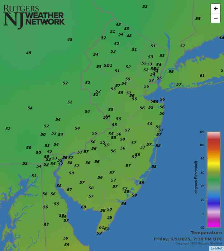
Latest Temperatures

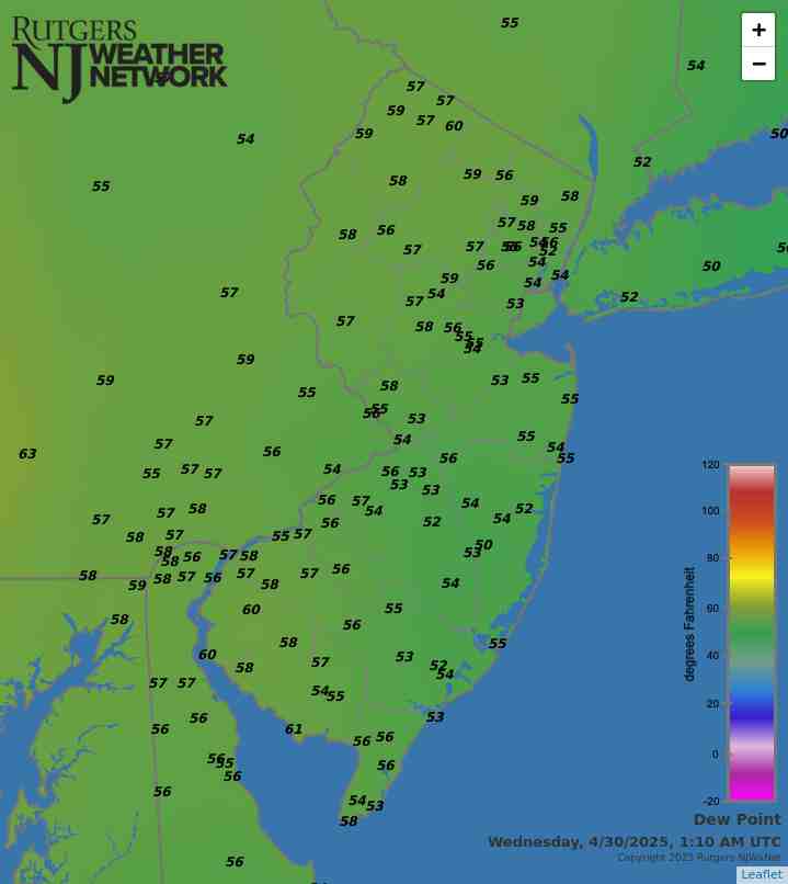
Current Dew Point

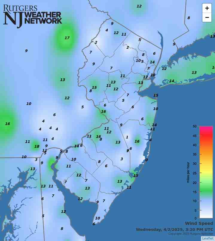
Latest Wind Speeds

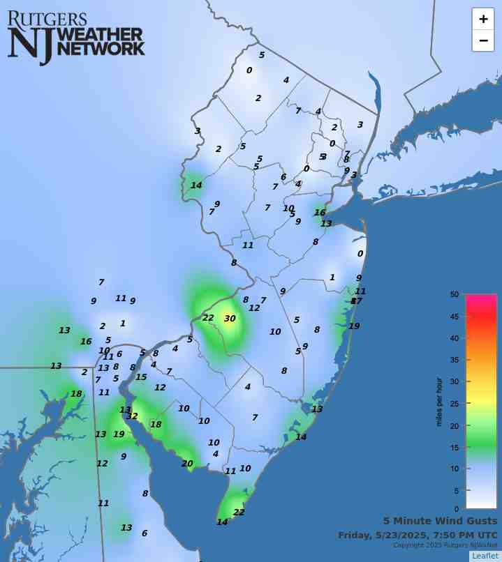
Wind Gusts

Top Story

Low-lying fog blankets a farm field in Sparta Township (Sussex County) on the morning of August 16th (photo courtesy of Nick Stefano).

While it is exceedingly rare to see monthly or seasonal temperature departures from normal differ in sign or even notable magnitude between southern and northern portions of New Jersey, such is not always the case for precipitation. This August and summer as a whole exemplify such disparities. While rain was often plentiful in the north, more often than not, the south did not see gauges fill as much or as often. This report will first address August conditions in the Garden State, finishing with a recap of climatological summer (June–August).

August precipitation averaged 6.52” across NJ. This is 1.95” above the 1991–2020 normal and ranks as the 22nd wettest August since records commenced in 1895. The northern climate division (Hunterdon-Somerset-Union and all counties to their north) averaged 8.53”. This is 3.97” above normal and ranks as the 10th wettest. The southern division (Mercer-Middlesex-Monmouth and all but immediate coastal areas to the south) came in at 5.39”. This is 0.82” above normal and ranks 41st wettest of the past 130 Augusts. The coastal division averaged 4.37”, which is 0.23” below normal and ranks 60th wettest (71st driest).

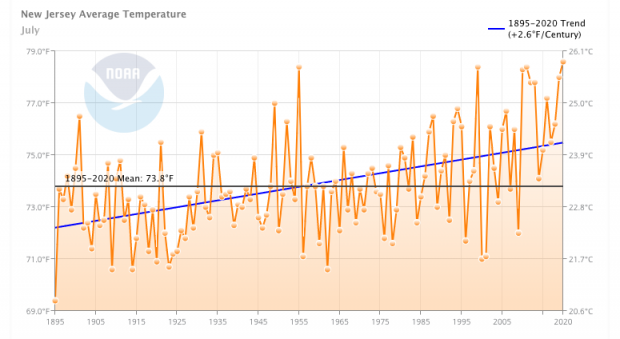
Despite wide-ranging weekly differences, statewide August temperatures were just 0.3° above normal, averaging 73.9°. This ranks as the 30th warmest back to 1895, certainly not near a ranking close to the mid-point of the entire period of record, thus exemplifying how much NJ has warmed over recent decades. The north averaged 72.2° (+0.3°, 28th warmest), the south 75.0° (+0.4°, 30th warmest), and the coast 75.0° (+0.3°, 25th warmest).

Latest Extremes

City, State Temp
Logan Twp., NJ 83
Hamilton, NJ 83
Hopewell Twp., NJ 82
Lower Alloways Creek, NJ 82
Mannington Twp., NJ 82
City, State Temp
High Point Monument, NJ 70
Vernon Twp., NJ 71
Harvey Cedars, NJ 73
High Point, NJ 73
Seaside Heights, NJ 73
most current information as of Sep 20 4:55 PM

Latest Conditions & Forecast

New Brunswick, NJ

Rutgers University Meteorology Program

79°F

Wind

2 mph from the NNE

Wind Gust

4 mph from the NE

Mostly Clear
59 °F
Mostly Sunny
79 °F
Partly Cloudy then Slight Chance Showers
59 °F
Mostly Sunny
75 °F
Partly Cloudy
56 °F
Partly Sunny
72 °F
Mostly Cloudy
56 °F
Mostly Cloudy
69 °F
Chance Showers
59 °F
Chance Showers
71 °F
Chance Showers
61 °F
Chance Showers
74 °F
Chance Showers
60 °F
Mostly Cloudy
75 °F

Tonight

Mostly clear, with a low around 59. East wind around 5 mph becoming calm in the evening.

Saturday

Mostly sunny, with a high near 79. Northeast wind around 5 mph.

Saturday Night

A slight chance of showers after 2am. Mostly cloudy, with a low around 59. East wind around 5 mph becoming calm in the evening. Chance of precipitation is 20%.

Sunday

Mostly sunny, with a high near 75. Northeast wind around 5 mph.

Sunday Night

Partly cloudy, with a low around 56. East wind around 5 mph becoming calm in the evening.

Monday

Partly sunny, with a high near 72.

Monday Night

Mostly cloudy, with a low around 56.

Tuesday

Mostly cloudy, with a high near 69.

Tuesday Night

A chance of showers. Cloudy, with a low around 59. Chance of precipitation is 40%.

Wednesday

A chance of showers. Cloudy, with a high near 71. Chance of precipitation is 40%.

Wednesday Night

A chance of showers. Cloudy, with a low around 61. Chance of precipitation is 50%.

Thursday

A chance of showers. Mostly cloudy, with a high near 74. Chance of precipitation is 40%.

Thursday Night

A chance of showers. Mostly cloudy, with a low around 60. Chance of precipitation is 30%.

Friday

Mostly cloudy, with a high near 75.

Search by zipcode or city/state for the latest conditions, forecasts, graphs, maps and more nearest to you.

More News

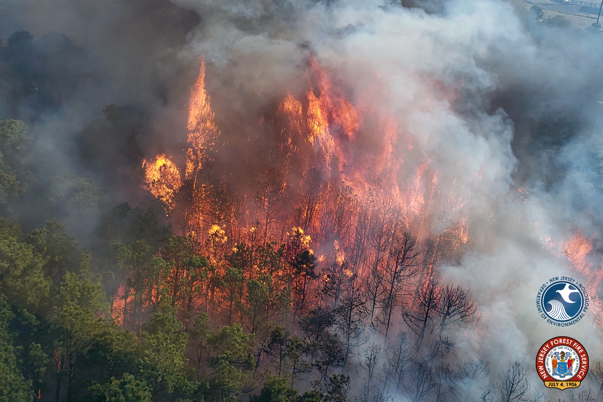
A smoke plume from the early July Tea Time Hill fire in Wharton State Forest (photo courtesy of the NJ Forest Fire Service).

Yet another warmer-than-normal July is in the books. This first sentence is just how last July’s report began. With a statewide average temperature of 77.9°, July 2024 ranked as the 7th warmest since records commenced in 1895. It was 2.5° above the 1991–2010 normal. The average high of 87.8° was 2.1° above normal, ranking 10th warmest. The average low of 68.0° was 2.9° above normal, ranking 3rd warmest. Eight of the ten warmest Julys have occurred since 2010 and ten of fifteen since 1999. Only three Julys in the past 25 years have averaged below the 1991–2010 normal. The June-July average...

Photo of a rain shaft over lower Greenwood Lake (Passaic County) taken from Hewitt on June 7th (photo courtesy of Rich Stewart).

Above-average temperatures ruled in June. So, what else is new? As will be seen later in this report, the first half of 2024 ranked as the second warmest since statewide records commenced in 1895. June 2024 was also the 7th consecutive month with temperatures above the 1991–2020 average and 10th of the last 12 in that category. June itself came in as New Jersey’s 2nd warmest, tied with 1943 and just behind 2010. Six of the 11 warmest have occurred since 2005. The 73.6° average was 3.3° above normal. The average high of 85.1° was 4.1° above normal, tied for the 2nd warmest, and the average...

A rainbow (note a slight double rainbow) early on the evening of May 15th, looking east from Shawnee, PA, across the Delaware River with the NJ Kittatinny Ridge in the background (photo courtesy of Erin Daly).

As spring turns to summer, all in Jersey can be pleased that water supplies are in good shape. Also, while it took some time to become established, by late May, warmer temperatures brought out summer wardrobes. Spring (March–May) conditions will be covered later in this report, but first a look at May. As the title of the monthly portion of this narrative suggests, May 2024 never established a consistent atmospheric pattern. There were plenty of episodes where light to moderate showers dotted the state, but never a broad soaker. Temperatures fluctuated on a weekly basis, without a...

More News

Exploring NJWxNet Solar Radiation Observations

March 20, 2020 - 11:52am -- Rohan Jain

Solar panels photo

Serving a wealth of potential user needs, solar radiation is one of the many variables observed at stations within the Rutgers NJ Weather Network (NJWxNet). Dating back as far as 2004, the original solar network of a half dozen stations has grown to the current 46. The solar instruments record incoming radiative fluxes in the 0.36 to 1.12 micron range. A myriad of products stem from observations, initially gathered once each hour and, since mid-2012, every five minutes. These include radiation maximums, averages, minimums (W/m²), and totals (kJ/m²), at five minute, hourly, and daily time scales.

Solar data gathered at NJWxNet sites help promote an understanding of the relationship between solar radiation and terrestrial systems involving the heating of the surface and atmosphere, plant growth, human health, and energy generation. Atmospheric conditions influence the magnitude of irradiance reaching the surface, with variables such as cloud cover, humidity, and aerosols (minute natural and human-generated liquid or solid particles) influencing incoming radiation. Prior to the advent of the NJWxNet, solar radiation observations across the Garden State were few in number and most often not of a continuous long-term nature. This was the case elsewhere in the US prior to the recent establishment of mesonets, such as the NJWxNet, in many states.

More Like Virginia: February 2020 and Winter 2019/20 Recaps

March 3, 2020 - 10:57pm -- Dave Robinson

Controlled burn smoke photo

Following on the heels of the 8th mildest January on record, February 2020 entered the books as the 3rd mildest since records began in 1895. The 39.2° average was 5.7° above the 1981–2010 mean. The northern climate division of the state averaged 36.2° (+5.2°; 6th mildest), the south was 41.0° (+6.1°; 3rd mildest), and the coastal division was 41.2° (+5.7°; 3rd mildest). Average minimum temperatures ranked 2nd mildest for the state, while average maximums ranked 8th mildest. To place February 2020 in some perspective, it was just 1.6° below the 1981–2010 March average of 40.8° and only 0.2° below the longer 1895–2019 March average. It was close to the long-term (1981–2010) average February temperatures in Washington, DC, Paducah, KY, and Bristol, TN.

February precipitation (rain and melted snow) came in very close to the 1981–2010 average at 2.82”. This is just 0.02” above average and ranks as the 62nd driest (and 65th wettest) of the past 126 years. Divisional totals ranged from 2.48” (-0.34”, 49th driest) in the north, 2.99” (+0.21”, 60th wettest) in the south, and 3.37” (+0.48”, 51st wettest) at the coast.

Where is Winter?: January 2020 Recap

February 4, 2020 - 2:01pm -- Dave Robinson

Boardwalk photo

The new decade got off on a rather unwintry note, with January temperatures well above average, snow rarely falling, and just one significant storm that brought only rain. The statewide average temperature of 37.3° was 6.6° above the 1981–2010 mean. This ranks as the 8th mildest January (tied with 1933) since records commenced in 1895. Anomalies and rankings were quite similar across the state. January 2020 was milder than December 2019 by 1.0°. The last time this climatological flip occurred was in December 2005/January 2006. Most notably, January 11th and 12th saw record daily temperatures in the upper 60°s to as high as 70°.

Precipitation fell mostly in the form of rain and mainly on the 25th. The monthly average across NJ was 2.38”. This is 1.02” below the mean and ranks as the 26th driest. The north was 1.27” below average, the south -0.84”, and the coast -1.12”, with all divisional totals between 2.14”–2.55”.

Winter Arrives Up North, Not So Much in the South, and Another Mild and Wet Year: December and 2019 Annual Recaps, Including Top 10 Events

January 7, 2020 - 5:22pm -- Dave Robinson

Freezing rain photo

There were multiple faces to December weather around the Garden State. Regionally, the north received above-average snowfall, several episodes of freezing rain, and over two weeks of snow cover, particularly at higher elevations. Central and southern areas saw less snow than average and temperatures a little milder than normal compared to up north. There was also a notable difference between the first and second halves of the month, with the first being stormy and the second having just one storm.

Despite a wintry start to the month, the statewide average temperature of 36.3° was 1.1° above the 1981–2010 normal and ranks as the 29th mildest since 1895 (tied with 2016). The north portion of the state averaged 33.1° (+0.4°), the south 38.2° (+1.6°), and the coast 39.4° (+1.7°). Despite a rather dry second half, the 5.56” of rain and melted snowfall averaged across the state was 1.71” above average, ranking as the 19th wettest (tied with 2012). The coast was wettest, averaging 6.09” (+2.33”), followed by the south with 5.60” (+1.81”), and then the north with 5.44” (+1.49”). Snowfall averaged 3.2”, which was 1.6” below average. The north came in with 8.0”, or 1.4” more than average, while the central area had 3.4” (-2.0”) and the south 0.5” (-3.1”).

Cold and Dry (A Rarity of Late), and Quite the Transition Season: November and Fall 2019 Recaps

December 5, 2019 - 5:28pm -- Dave Robinson

Leaf bags

In what has been a monthly see-saw of an autumn in the precipitation department (more below), November totals were on the low side. The statewide average total of 1.83” was 1.78” below the 1981–2010 mean. This ranked as the 22nd driest November since 1895. The northern half of the state averaged 2.31”, which is 1.55” below normal and ranks 31st driest. The south was drier at 1.54”, which is 1.91” below normal and ties with 1991 as the 18th driest. Temperature-wise it was the coldest month compared to normal since last November and, along with March, only the second below average one since then. The statewide average temperature of 41.3° was 3.9° below normal and ranks as the 27th coldest (tied with 1920 and 1955) of the past 125 Novembers. The north average 38.9°, which is 4.2° below normal and ties with six other years as the 24th coolest. The south averaged 42.6°, which is 3.8° below normal and ties with 1954 and 1972 as 27th coolest. Of late, there have been warmer and drier months compared to the norm, such as this past September and colder and wetter months including this past March. However, the last time New Jersey experienced a noteworthy dry and cold month (of any month) was November 2012 when the statewide average temperature was 3.7° below average and the precipitation 2.31” below average.

So Much for a Flash Drought: October 2019 Recap

November 6, 2019 - 2:33pm -- Dave Robinson

As the 10th month of 2019 commenced, attention was on the continuing flash drought conditions across the Garden State. Lawns had gone brown and shallow rooted trees were losing their dull-colored leaves early. By the second week of the month, the US Drought Monitor showed all of NJ to be in either abnormally dry (D0) or moderate drought (D1) status (full disclosure: my recommendations are taken under consideration by the national author of each week’s map). Several rain episodes in the first half of the month, particularly in the north, began to stall any worsening of conditions. However, it wasn’t until the last half that five events deposited an inch or more, three of them with two inches or more, at a number of locations around the state. Thus by month’s end, only portions of southwest, southeast, and central NJ were rated D0, and the remainder, as we like to say, in “D nada.” This turn to storminess didn’t come without consequences. This included localized flash and small stream flooding on occasion, several episodes of strong winds, and some minor to moderate coastal flooding. More on all of this below, but first to further summarize the month. In the precipitation department, the statewide average was 5.79”. This is 1.90” above the 1981–2010 normal and ranks as the 15th wettest dating back to 1895. North Jersey came in with an average of 6.72”, some 2.41” above normal and ranking 10th wettest. In the south, the 5.28” average was 1.65” above normal and ranks as the 20th wettest.

As if the wet month was not newsworthy enough, the statewide monthly temperature of 58.0° tied with two other years as the 9th warmest back to 1895. This is 3.5° above normal, with northern and southern portions coming in at 3.2° and 3.8° above, respectively. The 2nd was arguably the hottest October day on record, thus also the warmest for so late in the season. Meanwhile, several locations experienced the first freeze of the season on the 4th or 5th, with a more widespread frost and freeze on the 19th. Still, the month ended with only 18 of the 63 NJWxNet stations having fallen to the freezing mark.

Off Goes the Faucet: September 2019 Recap

October 7, 2019 - 5:26pm -- Mathieu Gerbush

Drought photo

No months prior to this past September have been drier across New Jersey since February 2009, a testament to how precipitation has leaned toward the wet side since the last major drought impacted the state in 2002. The 1.21” received this September was 2.84” below the 1981–2010 average. This ranked as the 7th driest September since records commenced in 1895. February 2009 saw only 0.66”, but since February is on average the driest month of the year (2.80”), the last time a monthly deficit was larger than this September was the 3.06” departure in September 2007. Since 2000, only six other months early in the century have been drier (February 2002: 0.75”, October 2000: 0.77”, March 2006: 0.82”, October 2001: 0.93”, November 2001: 1.00”, and September 2005: 1.19”).

Conditions were driest in the north, averaging 1.06”, which is 3.41” below normal and ranks as the 4th driest September on record. Southern NJ ranked 12th driest with 1.30”, which is 2.52” below normal. This “flash drought” depleted soil moisture, resulting in brown lawns and shallow-rooted trees losing leaves early. Fire danger also increased, resulting in a ban on open fires. At month’s end, the US Drought Monitor had most of NJ in the D0 (abnormally dry) category, with Salem County experiencing moderate drought (D1) conditions. Thanks to above-average precipitation earlier this year, northern NJ reservoir levels remained above early-fall averages. Certainly, a watchful eye will be kept on all water resources should this dry spell continue.

Above-average temperatures helped to dry things out in September. The 69.1° statewide average was 3.3° above the 1981–2010 mean. This ranks as the 8th warmest September over the past 125 years (tied with 1921; Table 2). Southern areas were warmest, at 3.5° above normal, while the north was 2.8° above.

Leaning Warm and a Bit Dry, and Once Again, Top-Ten Warmth: August and Summer 2019 Recaps

September 6, 2019 - 2:03pm -- Dave Robinson

Flash flood photo

The summer of 2019 concluded on a warm and a bit dry note when averaged across the Garden State. The warmth was a common theme throughout June to August, while the earlier summer months were on the wet side. The average August temperature of 74.4° was 1.4° above the 1981–2010 mean and is tied with 1983 and 1973 as the 14th warmest since 1895. On 12 days, the temperature topped out at 90° or hotter at one or more Rutgers NJ Weather Network station, but never exceeded 96°. The heat was somewhat tempered by seven mornings with lows in the 40°s at some northwestern NJWxNet locations.

August precipitation averaged 3.75” across NJ. This was 0.35” below normal and ranks as the 52nd driest of the past 125 Augusts. As expected during a summer month that is dominated by hit and miss showers, rainfall totals varied quite a bit, even on a local scale. The driest location in the state was Lambertville in Hunterdon County where 1.48” fell, while the wettest was Lebanon, also in Hunterdon County, with 7.99”. When and where the storms struck, they were, at times, intense. This included small tornadoes and more widespread strong winds, dangerous lightning, and flash flooding.

Exploring NJWxNet Soil Temperature and Water Content Observations

August 13, 2019 - 4:46pm -- Rohan Jain

Photo of Pittstown NJWxNet station

Observations of soil temperature and water content are among the many variables gathered at stations within the Rutgers NJ Weather Network (NJWxNet). While observations at 5 and 10 centimeter (cm) depths for water content have been taken at about a dozen NJWxNet stations as far back as 2003, only since 2013 have soil temperature and water content observations been taken at 5 cm, 10 cm, 20 cm, and 50 cm at currently nine stations across New Jersey. The soil and atmospheric observations at these sites provide an understanding of soil–atmosphere interactions, such as how soil conditions respond to atmospheric forcings. Soil temperature and water content also influence atmospheric conditions; however, this is exceedingly difficult if not impossible to demonstrate at individual locations. Prior to the advent of the NJWxNet, soil temperature and water content observations were almost completely lacking across NJ. This was the rule across the United States and beyond until recently when mesonets, such as the NJWxNet, began providing vital data that will continue to lead to improved short- and long-term weather and climate forecasts.

The objective of this report is to introduce the soil data being gathered at NJWxNet stations and to demonstrate the potential value of these observations to agricultural, hydrological, meteorological, engineering, and other communities. For instance, for the agricultural community, the difference between a bountiful harvest and a subpar one is quite dependent on soil conditions, not solely on what is occuring in the atmosphere. Understanding present soil conditions and analyzing past trends of soil water content and temperature can help a farmer determine when to plant, what crops to plant and, once growth commences, when to irrigate.

Mother Nature Picking on Two NJ Communities!: July 2019 Recap

August 4, 2019 - 2:30pm -- Dave Robinson

Thunderstorm wind damage in Holmdel

With 565 incorporated communities in New Jersey, one would think that the odds of multiple significant weather events specific to any one of them within a month would be exceedingly rare. Yet July 2019 brought such a duel scenario to not one but two NJ townships. Mt. Laurel (Burlington County) was visited by two tornadoes, while one rain gauge in Stafford Township (Ocean) caught 5.00” in two separate 24 hour periods. More specifics are provided later in this report. The good news is that, despite damage occurring in each of the four events, there were no fatalities nor reported injuries.

The month as a whole was a wet one, averaging 6.15” across the state. This is 1.58” above the 1981–2010 mean and ranks as the 20th wettest since 1895. Northern counties were wettest, averaging 7.20” or some 2.45” above normal and ranking 16th wettest. The south averaged 5.61”, which is 1.12” above normal and ranks 29th wettest.

Ten of the past 12 months and 15 of the past 18 months have received above-average precipitation across the state. While the 12 months ending in January this year ranks as wettest (66.61”) of 1484 such intervals dating back to 1895, the past 12 month period ending in July comes in second place with 65.74”, just ahead of the 12 months ending in June (65.50”).

Pages

Subscribe to Front page feed