Latest Temperatures

Current Dew Point

Latest Wind Speeds

Wind Gusts

Top Story

Cherry Blossom trees in full bloom at Branch Brook Park in Newark (Essex County) on April 10th. Photo by Tariq Zehawi/NorthJersey.com.

You would never have guessed it by looking at most days, with some wet, some dry, some warm, some cold, but put it all together and a rather normal April temperature- and precipitation-wise emerged from quite a variety of days and weeks. This is often the case during a transitional month (mid-fall or mid-spring), but this month took it to a bit of an extreme. Toss in a partial solar eclipse and an earthquake and it was quite the month for all who enjoy observing our fascinating world and solar system.

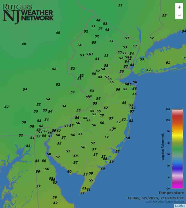
April precipitation averaged 4.14” across New Jersey. This is 0.44” above the 1991–2020 normal and ranks as the 42nd wettest of records dating back to 1895. Generally, the north received more rain than the south. The north climate division averaged 4.59” (+0.69”, 40th wettest), south division 3.89” (+0.31”, 48th wettest), and coastal division 3.65” (+0.10”, 61st wettest).

The year-to-date precipitation (rain and melted frozen precipitation) is 19.86”. This is 5.61” above normal and ranks as the 5th wettest January–April period on record. The top total is 22.98” in 1983 and the second through four wettest occurred in 1979, 1958, and 1953. The past 12 months have seen a state average 56.98” of precipitation, which is the 6th wettest of all such May–April periods dating back to 1895.

Latest Extremes

City, State Temp
Lyndhurst, NJ 65
West Deptford, NJ 65
Caldwell, NJ 65
Logan Twp., NJ 64
Pennsauken, NJ 64
City, State Temp
High Point Monument, NJ 54
Vernon Twp., NJ 56
High Point, NJ 57
Wantage, NJ 57
Charlotteburg, NJ 58
most current information as of May 9 8:00 PM

Latest Conditions & Forecast

New Brunswick, NJ

Rutgers University Meteorology Program

63°F

Wind

3 mph from the SE

Wind Gust

8 mph from the SE

Showers
50 °F
Showers
52 °F
Chance Showers
46 °F
Partly Sunny then Slight Chance Showers
63 °F
Chance Showers
47 °F
Chance Showers
60 °F
Partly Cloudy
46 °F
Mostly Sunny
71 °F
Mostly Cloudy
53 °F
Partly Sunny then Chance Showers
77 °F
Showers Likely
56 °F
Chance Showers
71 °F
Chance Showers
58 °F
Mostly Cloudy then Chance Showers
74 °F

Tonight

Showers. Low around 50. East wind around 5 mph, with gusts as high as 20 mph. Chance of precipitation is 90%. New precipitation amounts between a tenth and quarter of an inch possible.

Friday

Showers. High near 52. East wind around 10 mph, with gusts as high as 20 mph. Chance of precipitation is 90%. New precipitation amounts between a quarter and half of an inch possible.

Friday Night

A chance of showers before 2am. Mostly cloudy, with a low around 46. North wind 5 to 10 mph. Chance of precipitation is 40%. New precipitation amounts of less than a tenth of an inch possible.

Saturday

A slight chance of showers after 2pm. Partly sunny, with a high near 63. Northeast wind 5 to 10 mph becoming east in the afternoon. Chance of precipitation is 20%.

Saturday Night

A chance of showers, mainly after 8pm. Mostly cloudy, with a low around 47. Southeast wind around 5 mph. Chance of precipitation is 40%. New precipitation amounts of less than a tenth of an inch possible.

Sunday

A chance of showers. Mostly cloudy, with a high near 60. Chance of precipitation is 50%. New precipitation amounts of less than a tenth of an inch possible.

Sunday Night

Partly cloudy, with a low around 46.

Monday

Mostly sunny, with a high near 71.

Monday Night

Mostly cloudy, with a low around 53.

Tuesday

A chance of showers after 2pm. Partly sunny, with a high near 77. Chance of precipitation is 30%.

Tuesday Night

Showers likely. Mostly cloudy, with a low around 56. Chance of precipitation is 60%.

Wednesday

A chance of showers. Mostly cloudy, with a high near 71. Chance of precipitation is 50%.

Wednesday Night

A chance of showers. Mostly cloudy, with a low around 58. Chance of precipitation is 50%.

Thursday

A chance of showers. Mostly cloudy, with a high near 74. Chance of precipitation is 40%.

Search by zipcode or city/state for the latest conditions, forecasts, graphs, maps and more nearest to you.

More News

Looking south from Island Beach State Park toward Long Beach Island and the Barnegat Lighthouse on March 20th (photo by Dave Robinson).

So much for March flipping from lion to lamb or vice versa. March 2024 was often a lion throughout, with frequent roaring winds and multiple rain events producing a near-record monthly precipitation total and occasional flooding. The first half of the month ran at a record-warm pace, the monthly average later to be tempered by a second half that was cooler than the first. Still, the month emerged as the 9th mildest on record. Befitting the overall mild conditions, snowfall was scarce to non-existent. Winds gusted to 35 mph or higher at one or more Rutgers NJ Weather Network (NJWxNet)...

Sunset at Colonial Park in Franklin Township (Somerset County) on February 15th (photo by Dave Robinson).

Perhaps the title of this report is a bit overstated when it comes to February weather conditions, but not by all that much. However, like much of the coterminous United States, it applies rather appropriately to the December 2023–February 2024 winter. New Jersey’s winter conditions follow at the end of this report, with February discussed first. February 2024 was on the dry side. In fact, the statewide average precipitation (rain and melted snow) of 1.55” was 1.31” below the 1991–2020 normal and ranks as the 12th driest since records began in 1895. The northern climate division averaged...

An ice-encased walkway and railings generated from spray from Great Falls (background) in Paterson (Passaic County) during the cold January outbreak (photo courtesy of Liz Reilly).

The first month of 2024 provided a potpourri of weather happenings, including excessive rainfall and flooding, multiple snowfalls, frequent strong winds, frigid days, occasional warmth, and culminating with persistent dismal (aka damp, cloudy) conditions. Something for anyone or perhaps not favored conditions for most people. Totaling up the multiple precipitation episodes, this month emerged as the 6th wettest January on record dating back to 1895. It was the wettest January in 25 years and follows this past December, which was the wettest on record. The statewide 6.39” of rain and melted...

More News

Winter 2013/14: Round One

December 18, 2013 - 12:00am -- Dave Robinson

NASA MODIS satellite imagery

Following a mild six days of December, when a number of locations approached or exceeded the 50° mark for highs, the bottom fell out of the thermometer. From the 7th through the 18th most of the northern half of the state failed to reach 40°, while southern locations only saw milder highs on the 14th, early on the 15th, and on the 17th. This includes the first sub-zero observation of the winter, when -1° was reached at Walpack (Sussex County) on the 17th and again on the 18th.

Encroaching Drought?: November and Fall 2013 Summary

December 1, 2013 - 12:00am -- Dave Robinson

Dry reservoir photo

The first statewide nor'easter of the season on the 26th-27th provided much needed rainfall and kept the month from becoming one of the driest on record. Storm specifics are found below, confirming that this event accounted for the bulk of the statewide monthly average of 2.83" and at least temporarily staved off worsening drought conditions. This was 0.81" below the 1981-2010 normal and ranked as the 52nd driest of the past 119 years. Temperatures seesawed a fair bit but overall, colder than average conditions prevailed for the second consecutive November. The statewide average of 43.0° was 2.6° below normal and tied with 1906, 1919, 1940 and 1986 as the 36th coolest on record. Rather frequent frontal passages resulted in winds gusting to 40 mph or greater on twelve November days.

Pre-Thanksgiving Soaking

November 28, 2013 - 12:00am -- Dave Robinson

Snow photo

The first statewide nor’easter of the season soaked the Garden State on Tuesday and Wednesday the 26th-27th. Heavy rain, some northwest freezing rain, and strong winds contributed to holiday travel woes, though fortunately the worst conditions occurred during the overnight hours of Tuesday into Wednesday. The excellent National Weather Service forecasts had everyone aware of the potential storm days in advance, which helped in planning and preparation.

A Tranquil October (Imagine That!): October 2013 Summary

November 4, 2013 - 12:00am -- Dave Robinson

Damage from tornado in Paramus on October 7th. Photo Credit: Michael Harger
Following the past two October 29ths, it was wonderful to see sunny skies and seasonable maximum temperatures ranging from the mid to upper 40°s in the northwest to the low to mid 60°s in south this 29th. As a matter of fact, aside from a strong frontal passage blowing through the north on the 7th and a stubborn coastal storm impacting the south from the 9th-12th, conditions were quite tranquil throughout most of October 2013. A summer-like first week was the major contributor to the statewide monthly average temperature of 57.1° coming in 2.3° above normal. This ties with 1950 and 1951 as the 20th mildest October since statewide records commenced in 1895.

October begins with record warmth, a tornado, and strong winds

October 9, 2013 - 12:00am -- Dan Manzo

Damage from tornado in Paramus

The first week of October was nothing but bizarre, or at least to most New Jerseyeans it seemed that way. The period included unseasonably warm weather, heavy rain, strong winds and even a tornado. It was all credited to a stationary front that held in position in Southern New York, which allowed warm air to enter the Garden State. The warm air was later pushed out, when a sharp and potent cold front from the Midwest set off severe storms and heavy rain in parts of the area.

Cool and Dry Conditions Prevail: September 2013 Summary

October 1, 2013 - 12:00am -- Dave Robinson

Seaside Heights fire

September 2013 was the second consecutive month with the statewide average temperature coming in below normal. The 64.4° average was 1.8° below the 1981-2010 average. This ranks as the 40th coolest September since 1895, tied with 1920 and 1922, and the coolest since 1994.

Statewide precipitation averaged 2.40" in September. This is 1.67" below average and ranks as the 30th driest on record, tied with 1910. This is the first month since this past May with below-average precipitation.

First NJ Freeze of the Fall Season

September 24, 2013 - 12:00am -- Dave Robinson

Frost on grass

At 3:40 AM this morning, Tuesday September 24, the temperature at the NJ Weather and Climate Network (NJWxNet) SafetyNet station in Walpack (Sussex County) fell to 32°. This marks the first freezing observation of the fall season at a New Jersey location. With dense cold air draining from the surrounding hillsides, this northwest valley location is commonly amongst the coldest locations in the 56-station NJWxNet constellation. The Walpack temperature vacillated between a minimum of 31° and 32° the rest of the night until climbing to 33° at 6:45. Walpack had previously fallen to a summer minimum of 33° this month on September 17th and 18th.

Other chilly locations this morning include Pequest (Warren) 33°, Basking Ridge (Somerset) 35°, and nine other NJWxNet stations between 37°-39°. Meanwhile, coastal stations at Harvey Cedars (Ocean) and West Cape May (Cape May) were the mildest locations at 49°.

A Cool August and a Warm and Wet Summer of 2013

September 2, 2013 - 12:00am -- Dave Robinson

Tornado Damage

After two warm and wet months to start off the summer of 2013, August provided an about face in the temperature department. The 71.6° statewide mean is 1.8° below the 1981-2010 average and ranks as the 41st coolest August since statewide records commenced in 1895. It was only 0.1° warmer than this past June. Precipitation averaged 4.50", which is 0.29" above normal and makes this the 51st wettest of the past 119 Augusts.

What a change from July. There were only four afternoons when the temperature was 90° or higher somewhere in the state, compared with 18 in July. The warmest it got was 93° at Harrison (Hudson County) on the 21st and only nine stations reached 90° at some point during the month, compared to most of the 50 NJWxNet stations reaching that mark in July.

Yet another hot summer month: July 2013 Summary

August 4, 2013 - 12:00am -- Dave Robinson

Tornado Damage in Berkeley Heights

July 2013 marked yet another in a lengthening sequence of hot mid-summer months across New Jersey. Most notable this year was the frequency of unusually warm nighttime temperatures. Accompanying the warmth and often excessive humidity were widely varying rainfall totals, which on a statewide basis averaged above the long-term mean. The statewide average temperature of 78.2° was 3.2° above average. This ranks as the 5th warmest July since records commenced in 1895. Remarkably, the most recent four Julys all are within the top six, with three other Julys from the last 20 years also populating the top 10.

The statewide average temperature of 78.2° was 3.2° above average. This ranks as the 5th warmest July since records commenced in 1895 (Table 1). Remarkably, the most recent four Julys all are within the top six, with three other Julys from the last 20 years also populating the top 10.

No escaping a sultry, sweaty heat wave

July 22, 2013 - 8:09pm -- Dan Manzo

Garden State residents suffered through another heat wave last week, and at times it seemed like the unrelenting heat would never subside. A heat wave is unofficially defined as three or more consecutive days with the maximum temperature at or over 90°. This heat wave lasted seven days for many areas and furthermore, very high dew points (a measure of moisture in the air) made the heat index soar above 105°.

The heat wave began for many on Sunday, July 14, with stations in central and northeast Jersey, such as Haworth, Jersey City, New Brunswick, Howell, and Toms River all recording high temperatures in the low 90°s. Hawthorne was the hottest spot with a high temperature of 94°. Other stations recorded high temperatures in the upper 80°s. This combined with widespread dew points above 70° resulted in heat indices at or near 100°.

Pages

Subscribe to Front page feed