snow

Lost Winter: February 2024 & Winter 2023/2024 Recaps
March 7, 2024 - 5:34pm -- Dave Robinson

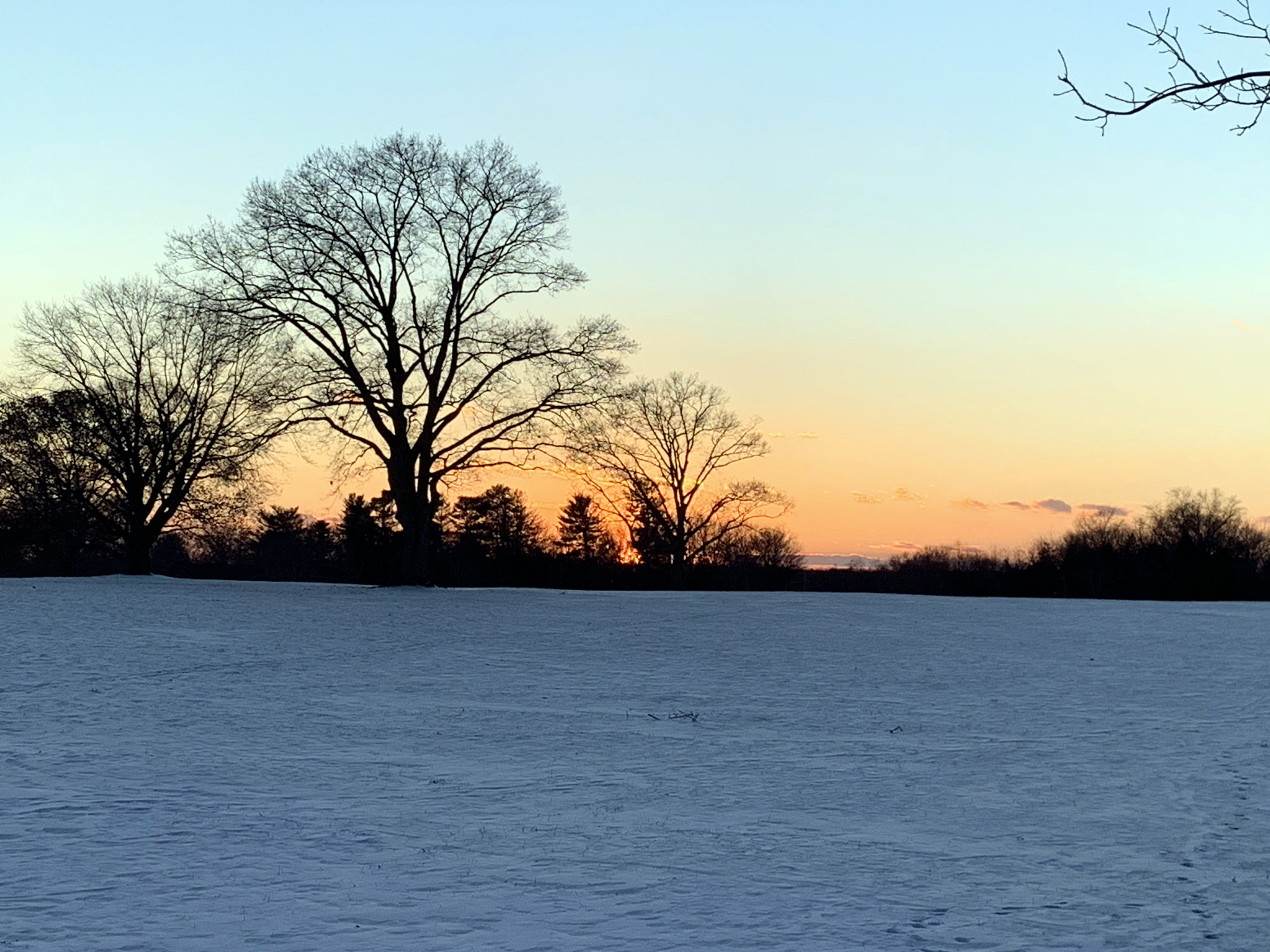
Sunset at Colonial Park in Franklin Township (Somerset County) on February 15th (photo by Dave Robinson).

Perhaps the title of this report is a bit overstated when it comes to February weather conditions, but not by all that much. However, like much of the coterminous United States, it applies rather appropriately to the December 2023–February 2024 winter. New Jersey’s winter conditions follow at the end of this report, with February discussed first.

February 2024 was on the dry side. In fact, the statewide average precipitation (rain and melted snow) of 1.55” was 1.31” below the 1991–2020 normal and ranks as the 12th driest since records began in 1895. The northern climate division averaged 1.68” (-1.11”, 12th driest), the southern division 1.47” (-1.42”, 10th driest), and the coastal division 1.44” (-1.63”, 7th driest).

February snowfall averaged 7.9” across NJ. This was just 0.3” below normal, ranking as the 51st snowiest since 1895. The North snow division averaged 12.4” (+2.1", 40th snowiest), Central 12.4" (+3.3", 36th snowiest), and South 3.2" (-3.5", 58th least snowy). The vast majority of the snow fell in two events four days apart, with mild temperatures that soon followed prohibiting the snow cover for sticking around for too long.

In fact, mild days outnumbered cold ones during February, leading to a monthly statewide average of 37.0°, which was 3.1° above normal and ranks as the 14th mildest on record. The statewide average daily high temperature of 46.3° was 3.2° above normal and ranks 16th mildest. The daily minimum of 27.8° was 3.2° above normal, ranking 9th mildest. The north averaged 34.9° (+3.6°, 12th mildest), south 38.3° (+2.8°, 16th mildest), and coast 38.4° (+2.4°, 16th mildest).

Take Your Pick: January 2024 Recap

February 6, 2024 - 8:52pm -- Dave Robinson

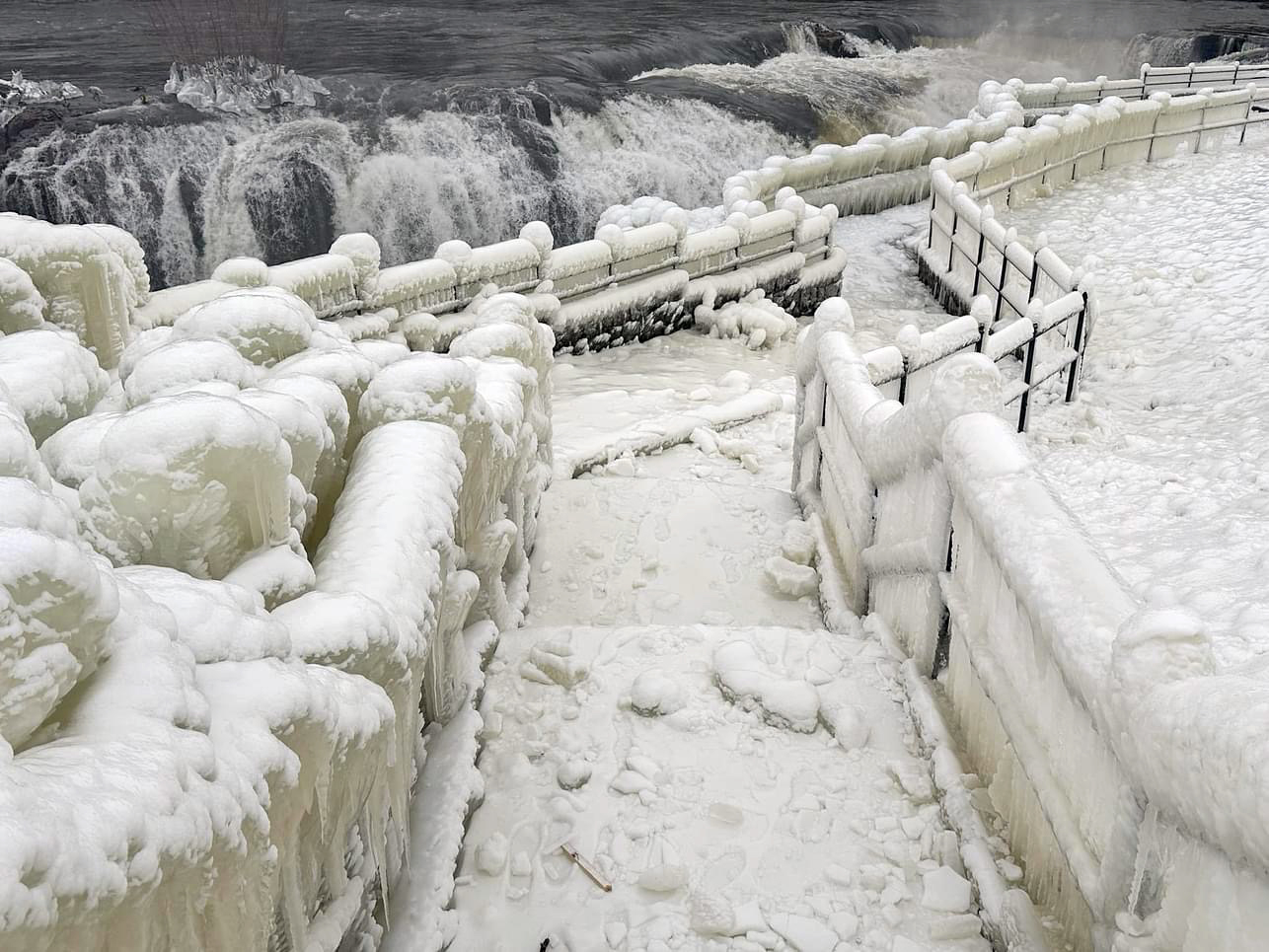
An ice-encased walkway and railings generated from spray from Great Falls (background) in Paterson (Passaic County) during the cold January outbreak (photo courtesy of Liz Reilly).

The first month of 2024 provided a potpourri of weather happenings, including excessive rainfall and flooding, multiple snowfalls, frequent strong winds, frigid days, occasional warmth, and culminating with persistent dismal (aka damp, cloudy) conditions. Something for anyone or perhaps not favored conditions for most people. Totaling up the multiple precipitation episodes, this month emerged as the 6th wettest January on record dating back to 1895. It was the wettest January in 25 years and follows this past December, which was the wettest on record. The statewide 6.39” of rain and melted snow was 2.90” above the 1991–2020 normal. The northern climate division averaged 6.70” (+3.20”, 5th wettest), the southern division 6.18” (+2.71”, 7th wettest), and the coastal division 6.48” (+2.97”, 6th wettest).

January snowfall averaged 7.0” across NJ. This is just 0.2” below normal and ranks as the 53rd snowiest January of the past 130 years. Snow divisions include the north, which averaged 8.9” (-0.5”, 52nd snowiest), central coming in with 5.9” (-1.8”, 65th snowiest), and south with 6.6” (+0.9”, 43rd snowiest).

Temperatures fluctuated throughout the month, ultimately averaging 34.7° statewide. This was 3.0° above normal and ranks as the 20th mildest January. The north averaged 32.3° (+3.4°, 17th mildest), south 36.1° (+2.7°, 22nd mildest), and coast 36.9° (+2.5°, 24th mildest). The statewide average maximum of 42.0° was 1.7° above normal, ranking as the 30th warmest. The statewide average minimum of 27.4° was 4.2° above normal, ranking 16th mildest.

Smoke Gets In Your Skies, and Another Mild One: May and Spring 2023 Recaps

June 7, 2023 - 6:43pm -- Dave Robinson

Wildfire smoke from western Canada contributed to a scenic sunrise on May 11 in Brigantine (Atlantic County). Photo courtesy of Connie Pyatt Photography.

When the headline for this monthly report alludes to hazy May skies that were frequently overhead, you know it was a quiet period weather-wise across the Garden State. Such was the case during the middle two weeks of May and at month’s end, with smoke from wildfires in western Canada frequently passing well overhead, followed by smoke from fires in Nova Scotia and a few in NJ. Otherwise, May temperatures were cooler than normal, and rainfall sparse.

The statewide average temperature of 59.3° was 1.9° below the 1991–2020 normal. This ranked as the 52nd coolest May since 1895. It was the coolest month compared to normal since January 2022. Following the third mildest April on record, May was only 4.0° milder than the previous month. This is the third smallest temperature difference on record between these two months. The average high temperature of 71.7° was 0.6° below normal, ranking 60th warmest and 68th coolest. The average low temperature of 46.9° was 3.3° below normal, ranking 26th coolest. The northern division averaged 57.8° (-2.1°, 50th coolest), the southern division 60.3° (-1.9°, 50th coolest), and the coastal division 59.6° (-1.4°, 63rd coolest).

Tempered Spring Advance: March 2023 Recap

April 8, 2023 - 3:52pm -- Dave Robinson

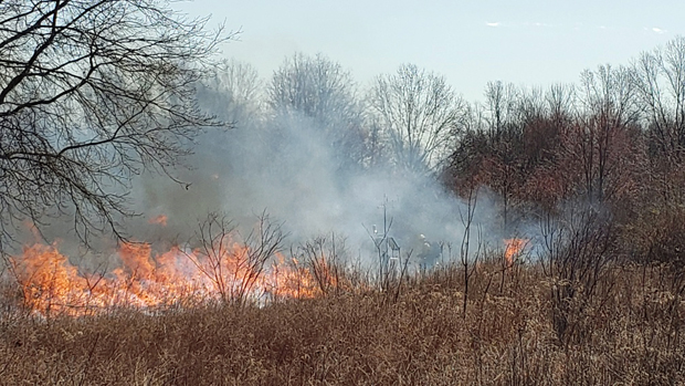
Controlled burn conducted near the Basking Ridge (Lord Sterling Park, Somerset County) Rutgers NJ Weather Network station by NJ Fire Service personnel on March 27th. Photo courtesy of Stephen Federico/Somerset County Park Commission.

While March temperatures came in above normal, they were not nearly as anomalously mild as those seen in January and February. This quelled concerns that an early blooming season might arise, one that could result in damaged vegetation had an early bloom been followed by an unseasonable cold spell. The average March temperature across NJ was 42.1°. This was 1.2° above the 1991–2020 normal and ranks as the 30th mildest March since 1895. The average maximum temperature of 52.2° was 1.3° above normal, ranking 37th mildest. The average minimum of 32.1° was 0.9° on the mild side, ranking 29th mildest. The National Centers for Environmental Information northern division averaged 39.8° (+1.0°, 31st mildest), the southern division 43.5° (+1.1°, 31st mildest), and the coastal division 43.7° (+1.5°, 23rd mildest).

Statewide, precipitation averaged 2.75”, which is 1.45” below normal and ranks 29th driest of the past 129 years. The northern coast and northeast were wettest and the southwest and far south driest. This was reflected in the northern division averaging 3.07” (-0.94”, 44th driest), southern 2.52” (-1.80”, 24th driest), and coast 2.84” (-1.58”, 30th driest).

March statewide average snowfall was 1.8”. This was 2.8” below normal and ranks as 49th least snowy. Northern counties averaged 5.4” (-1.8”, 56th least snowy), central counties 1.5” (-3.9”, 46th least snowy), and southern counties 0.0” (-2.7”, tied with 37 other years as least snowy).

Normally Abnormal: February 2023 & Winter 2022/2023 Recaps

March 7, 2023 - 4:28pm -- Dave Robinson

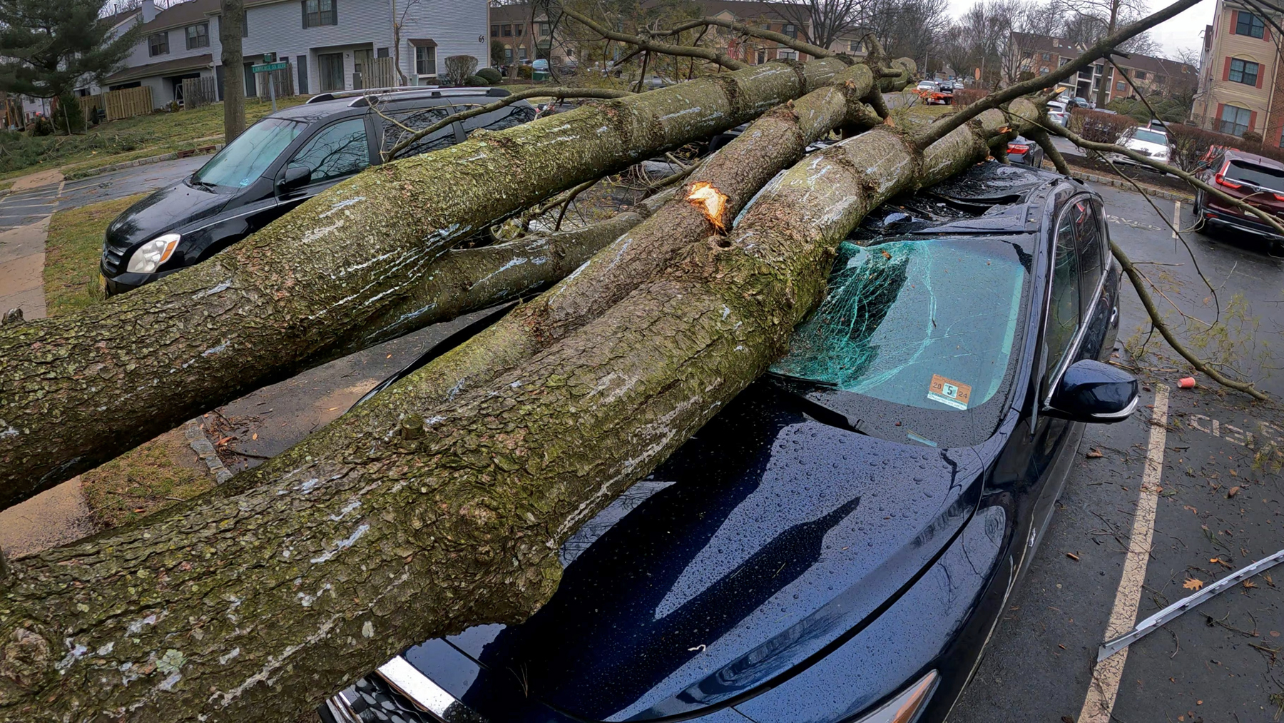
Tornado damage in the Lawrence Square Village housing complex in Lawrence Twp. (Mercer County) after an EF2 tornado tore through the area on the afternoon of February 21st. Photo by Michael Mancuso/NJ Advance Media.

Abnormal conditions were seemingly the norm cross the Garden State during the second month of 2023 and, for that matter, during much of the winter (December–February). More on winter later in this report. First, focusing on February, milder-than-normal temperatures and limited snowfall were the rule, a short-lived frigid blast was followed by 70° warmth, and the most notable February tornado of at least the past 74 years touched down.

The statewide average temperature of 38.9° was 5.0° above the 1991–2020 normal and ranked as the 5th mildest February since 1895 (tied with 2012). Five of the six mildest Februarys have occurred in the last 11 years. Exemplifying the warmth, the New Brunswick (Middlesex County) Cooperative station experienced 23 days with above-average temperatures and just five below average. The same was true at both Sussex (Sussex) and Newark Airport (Union). Atlantic City Airport in Pomona (Atlantic) had 18 above and ten below normal, and Cape May (Cape May) reported 21 above and seven below.

The average February maximum was 49.3°, which is 6.2° above normal and ranks 3rd mildest, while the average minimum of 28.5° was 3.9° above normal, ranking 7th mildest. Temperatures in the northern climate division averaged 36.0° (+4.7°, 7th mildest), southern 40.6° (+5.1°, 4th mildest), and coastal 41.1° (+5.1°, 3rd mildest).

Does Anybody Really Know What Month It Is?: January 2023 Recap

February 7, 2023 - 5:47pm -- Dave Robinson

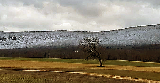
The pronounced snowline (at about 1000 feet elevation) near the base of Sunrise Mountain as seen from Rt 519 in the Beemerville section of Wantage (Sussex County) at 4:25 PM on January 23rd. Photo courtesy of Karen Walsh.

January 2023 was unlike most any first month of the year a New Jersey resident has experienced. Temperatures were similar to those normally seen in March and accumulating snowfall was meager in the north and non-existent further south. NJ weather was more like that of the piedmont of North and South Carolina at this time of year. The statewide average temperature of 41.0° was 9.3° above the 1991–2020 normal and ties with 1932 as the mildest January since records commenced in 1895. The average high of 48.9° was 8.6° above normal, ranking 2nd mildest. The average low of 33.1° was 9.9° above normal, also ranking 2nd mildest. It is indeed impressive to see the January 2023 monthly mean 0.7° warmer than the normal monthly high temperature and the average low was 1.4° above the normal monthly mean. The NCEI northern division averaged 38.8° (+9.9°, rank #1), the southern division 42.3° (+8.9°, #2), and the coastal division 43.0° (+8.6°, #2).

January precipitation averaged 3.65” across NJ, which is 0.16” above normal and ranks as the 45th wettest on record. This includes rain that fell during the PM hours of December 31st, as the clock starts on the new month (and in this case, also the new year) once observations are gathered at most NWS Cooperative stations around 7–8 AM each morning (much as what occurred on November 30, 2022, contributing to December totals). The northern division was wettest, averaging 4.19” of rain and melted snowfall (+0.69”, 31st wettest), the southern division 3.36” (-0.11”, 56th wettest), and the coastal division 3.01” (-0.50”, 78th wettest/52nd driest).

Seeking Identities:December 2022 and Annual 2022 Recaps

January 6, 2023 - 9:53pm -- Dave Robinson

Strong winds push waves and spray onshore after a cold frontal passage on December 23rd in Seaside Heights (photo credit: Daniel Nee/Lavallette-Seaside Shorebeat).

As has so often been the situation in 2022, December’s weather never settled into any persistent pattern. Unless, of course, a pattern of frequent variations constitutes persistence! In any case, it seems appropriate to co-label this combined monthly and annual report as intervals in search of identities!

Looking first at December, the statewide average temperature of 35.5° is 1.1° below the 1991–2020 normal. This ranks as the 44th mildest December dating back to 1895. The statewide average maximum temperature of 44.9° is 0.1° below normal and ranked 31st mildest. The average minimum was 26.1°, which is 2.1° below normal and ranks 54th mildest. North Jersey averaged 33.3° (-0.8°, 36th mildest), south Jersey 36.8° (-1.3°, 49th mildest), and the Jersey coast 37.7° (-1.4°, 50th mildest).

Statewide precipitation averaged 4.76”, which is 0.49” above normal and ranks 35th wettest. North Jersey averaged 4.93” (+0.68”, 32nd wettest), south Jersey 4.68” (+0.40”, 37th wettest), and the Jersey coast 4.49” (+0.13”, 43rd wettest). The wettest locations were in the northeast and along the northern coast, while the northwest and much of the south were on the drier side.

Spring Foolery: March 2022 Recap

April 6, 2022 - 7:56pm -- Dave Robinson

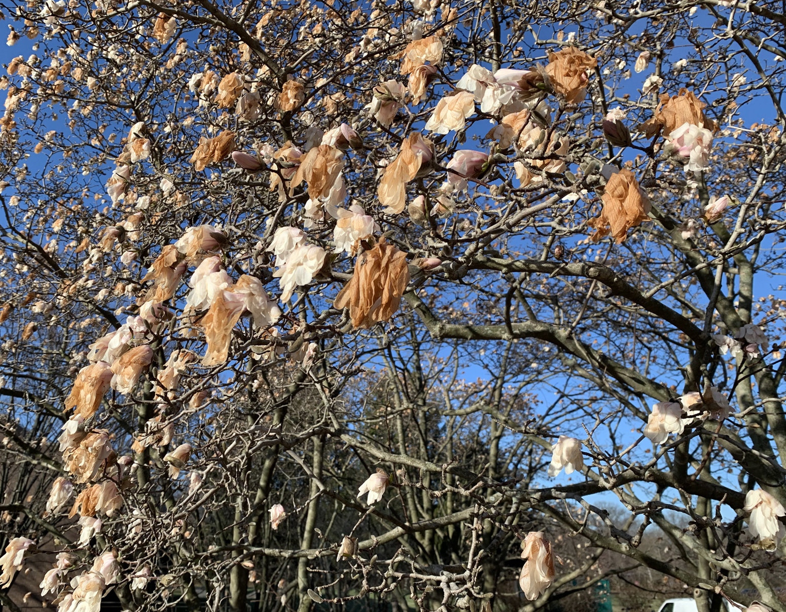
Damaged magnolia flowers on March 29th at Rutgers University Livingston Campus in Piscataway

When it comes to shedding the winter coat and thinking of warm weather to come, March is known to have its early spring teases. Then, along comes some late winter cold to remind us winter is not quite ready to disappear. This spring foolery was on exceptional display this month. High temperatures jumped into the 70°s on the 6th and 7th, then back to the cold until the 70° mark was again eclipsed during four of the five days from the 15th–19th. Next came some more seasonable temperatures before a polar blast brought mid-winter frigid conditions from the 28th–30th, only to be followed by another day of 70°s to end the month. Interspersed with these wild fluctuations were episodes of thunderstorms, snow and rain, and 13 days where winds gusted to greater than 40 mph at some locations.

When all was said and done, the statewide average temperature of 43.6° was 2.6° above the 1991–2020 normal. This ranked as the 16th mildest March since 1895, with the end-of-month cold spell keeping the month out of the top 10 for warmth. The average maximum of 54.0° was 3.1° above normal, ranking 17th mildest. The average minimum of 33.3° was 2.1° above normal, also ranking 17th. The north averaged 41.1° (+2.3°, 21st warmest), south 45.3° (+2.9°, 15th), and coast 44.9° (+2.7°, 13th).

Precipitation averaged 2.72” across NJ, which was 1.48” below normal and ranks as the 26th driest March since 1895. The north caught 2.54” (-1.47”, 26th driest), south 2.80” (-1.52”, 30th), and coast 3.06” (-1.36”, 34th). In particular, a zone from Hunterdon to Bergen counties was driest and the coast from Atlantic to Monmouth counties was wettest.

Up, Down, Round and Round: February 2022 and Winter 2021/2022 Recaps

March 8, 2022 - 12:53pm -- Dave Robinson

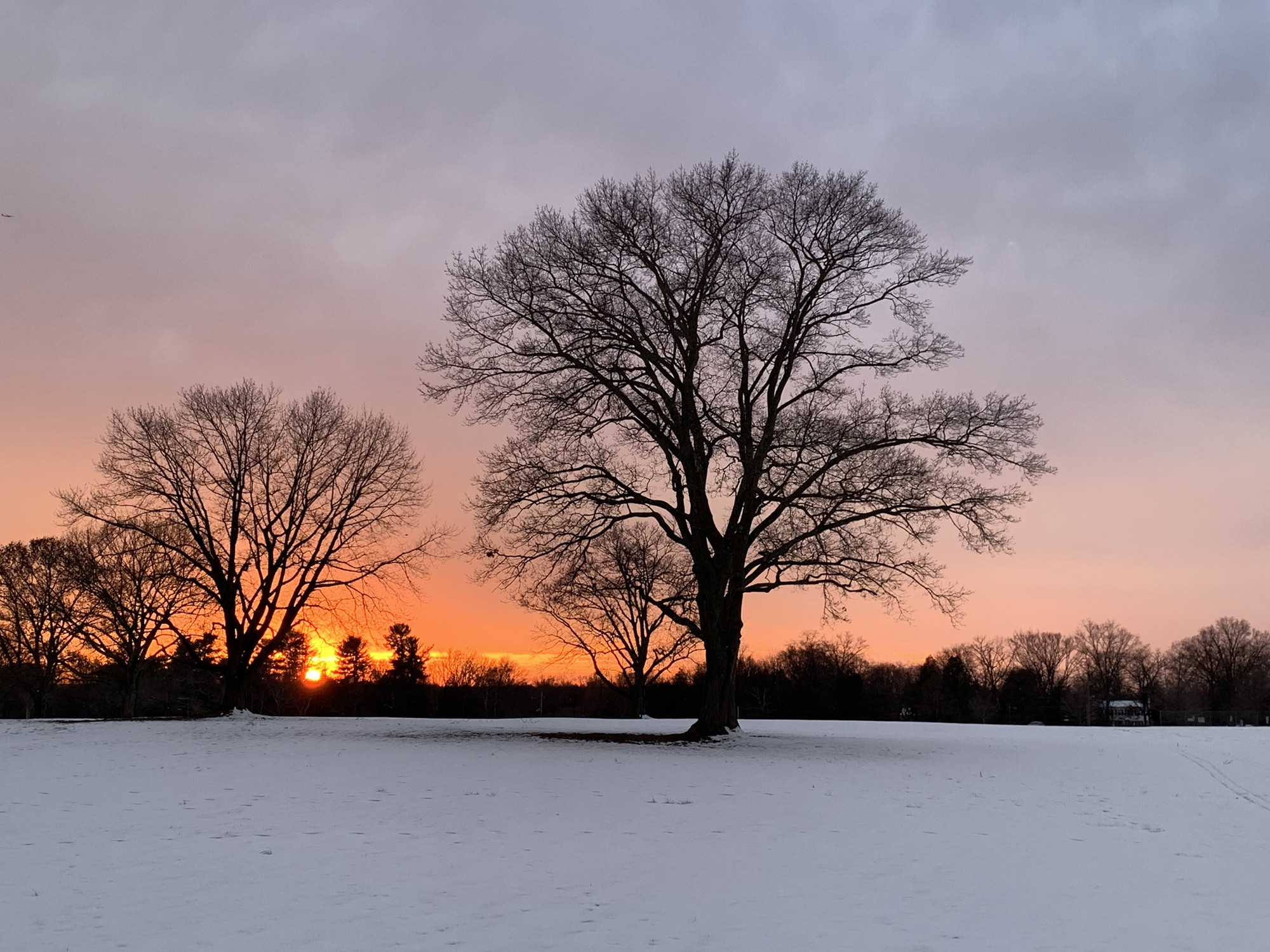
Sunset over a snow-covered field on February 14 at Colonial Park in Franklin Township (Somerset County).

The second month of 2022 and third month of winter continued a theme since December. Whether you call it a see saw, swing, or merry-go-round, it fits the theme of playground equipment as it never seemed any one particular variety of weather became established for all that long. More will be said about winter at the end of this report, but when it came to February, the end result was a somewhat warmer-than-normal month with about average precipitation and a dearth of snowfall. The statewide average temperature of 35.6° was 1.7° above the 1991–2020 normal, ranking as the 19th mildest since 1895. There was an above-average spread between the average high of 46.7° (+3.6°, 12th mildest) and low of 24.4° (-0.2°, 40th mildest), the 22.3-degree range being 3.8 degrees wider than normal. The north averaged 32.0° (+0.7°, 26th mildest), the south 37.7° (+2.2°, 16th mildest), and coast 37.9° (+1.9°, 18th mildest).

Rain and melted snow/sleet averaged 2.93”. This is 0.07” above normal and ranks as the 60th wettest/69th driest. The north averaged 3.45” (+0.66”, 44th wettest), south 2.62” (-0.27”, 49th driest), and coast 2.54” (-0.53”, 44th driest). More geographically specific, the far south was driest and the northwest wettest.

The South Coast Steals the Show: January 2022 Recap

February 8, 2022 - 10:40pm -- Dave Robinson

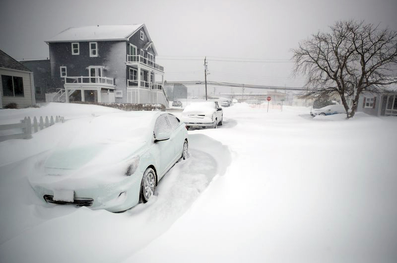
Severely drifted snow surrounds a car in Brigantine on January 29th.

When it comes to cold and snow, the second month of winter wasn’t anything like the first. New Jersey was right in the heart of winter to start off 2022, and nowhere was that more apparent than in southern coastal counties where far more than an average winter’s snow fell. At some locations, the total exceeded that of the most recent three winters combined. The prevailing storm track was such that the northwest corner of the state received the least snow, yet saw seven days with low temperatures dipping below zero. Toss in 15 days where one or more locations around the state recorded wind gusts of 40 mph or greater (five of these with gusts of at least 50 mph) and two atmospheric pressure waves moving across the state as a result of a volcanic eruption in the south Pacific, and it certainly was an eventful month.

Rain and melted snow averaged 3.45” across the state. This is 0.04” below the 1991–2020 normal and ranks as the 54th wettest (75th driest) January since 1895. The northern counties south to and including Hunterdon, Somerset, and Union averaged 2.90”, 0.60” below normal and 75th wettest (53rd driest). Southern counties, except close to the Atlantic Coast, averaged 3.72”, which is 0.25” above normal and ranks 46th wettest. The coastal region caught 4.34”, which is 0.83” above normal and ranks 31st wettest. Persistent dry conditions in recent months resulted in the southernmost NJ counties deemed “Abnormally Dry” for most of the month, according to the National Drought Monitor. As the month ended, northwestern counties were under consideration for being similarly designated.

Pages

Subscribe to RSS - snow